San Luca

San Luca

San Luca, Bologna

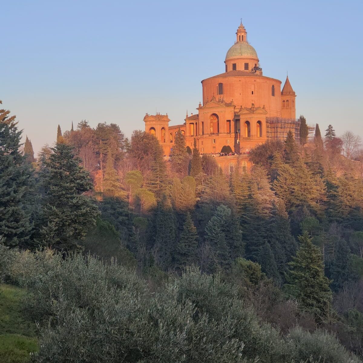
Sanctuary of the Madonna of San Luca

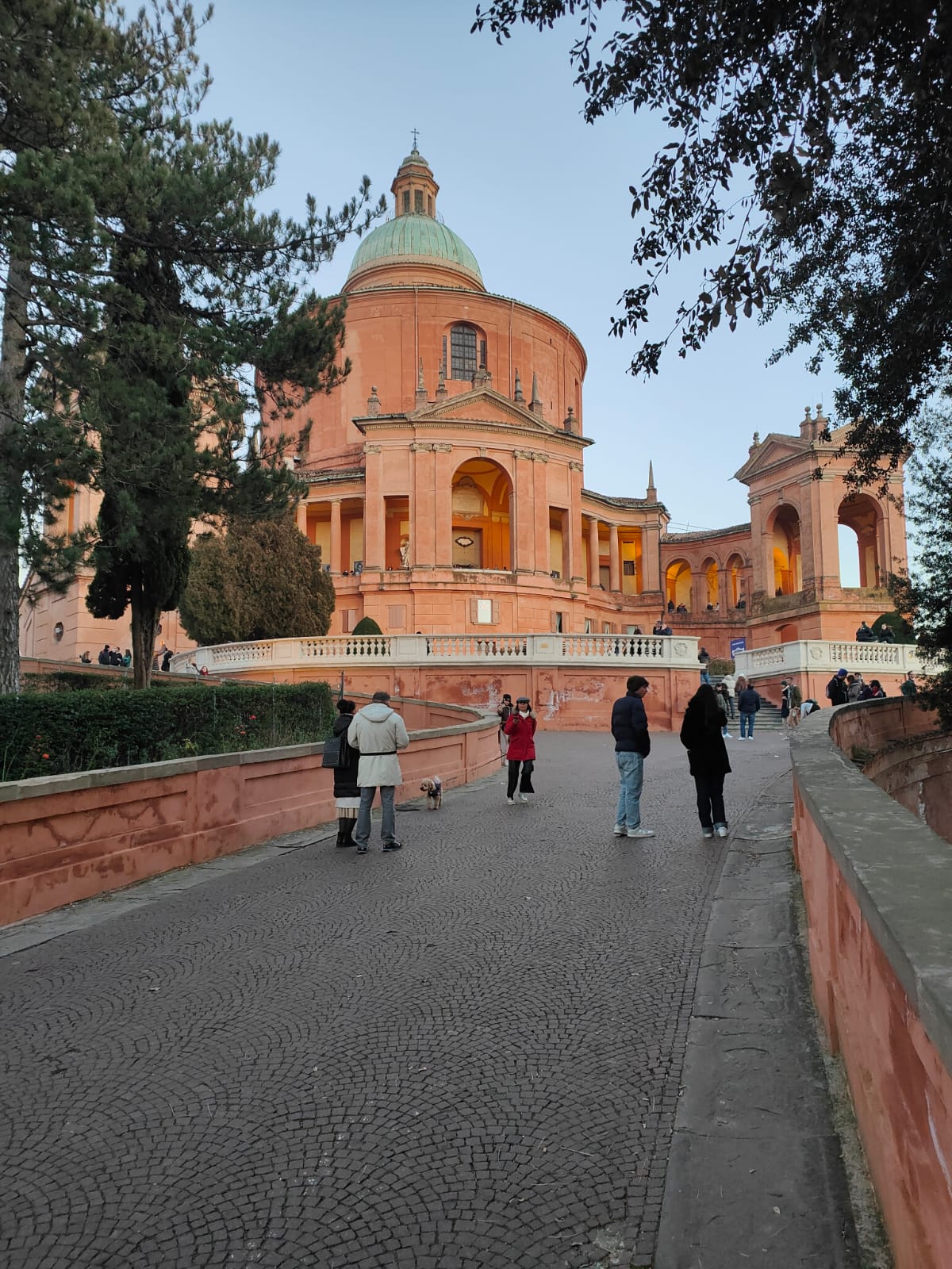
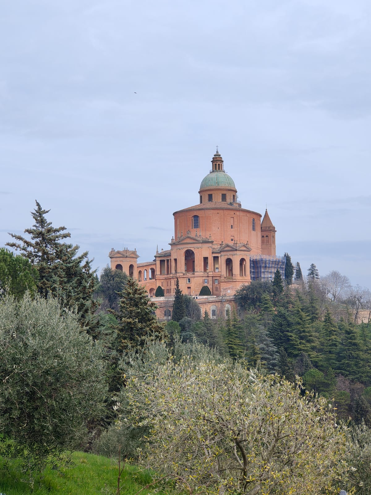
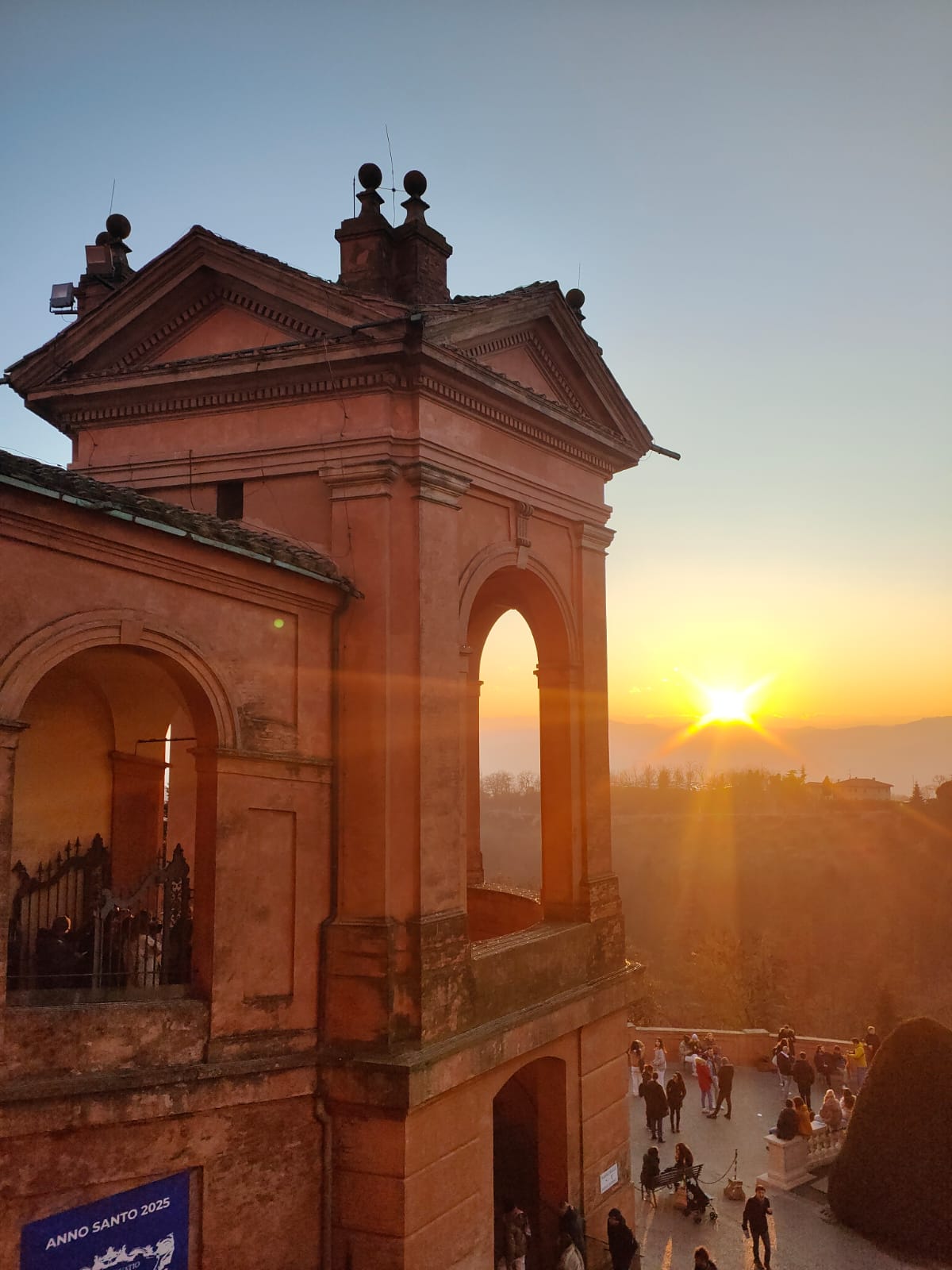
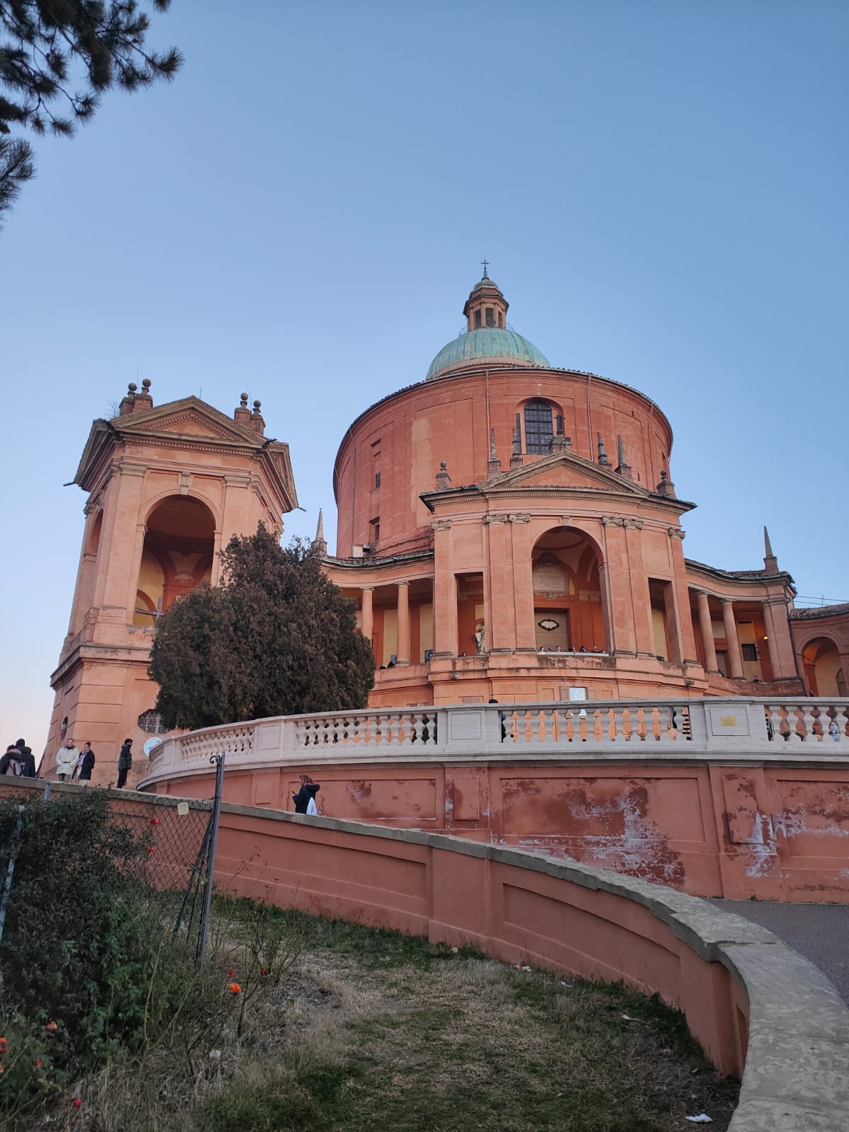
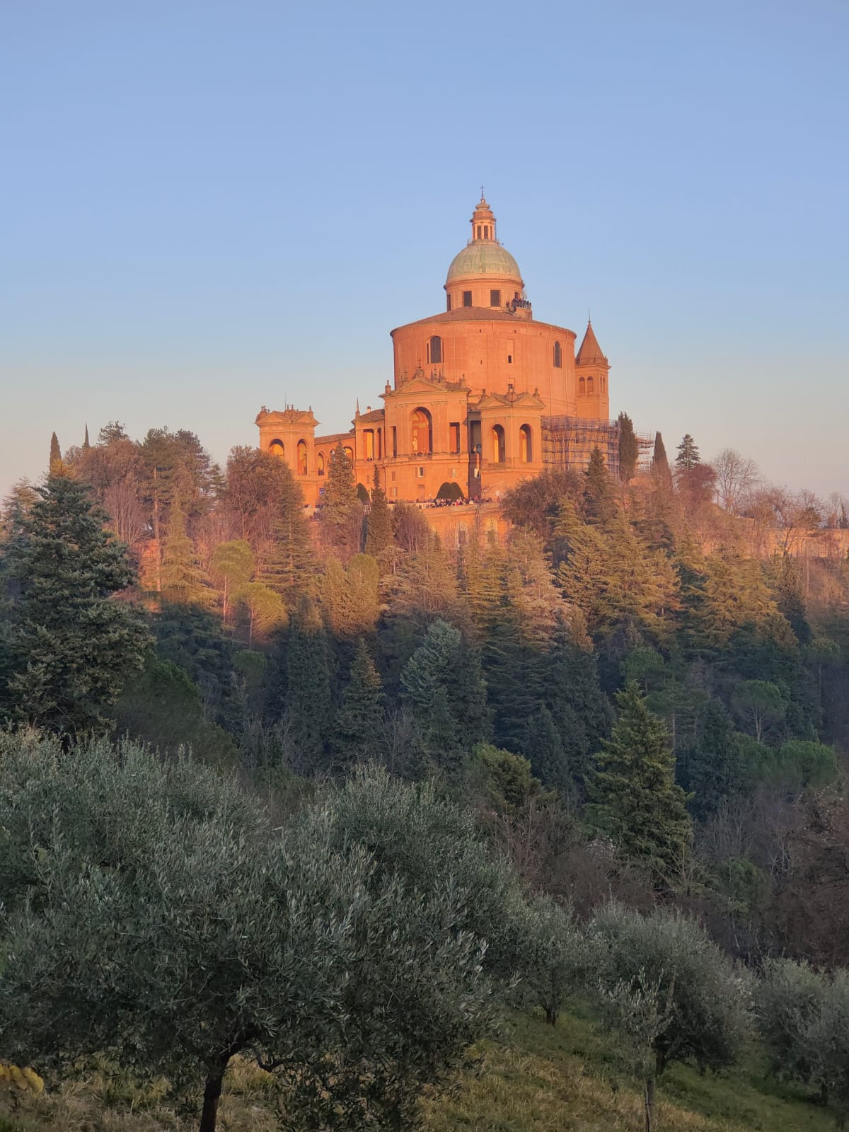
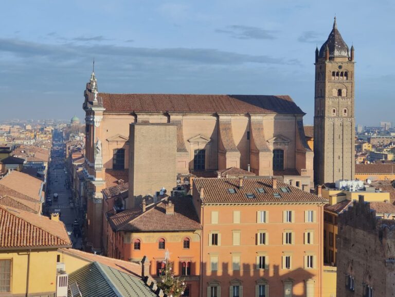
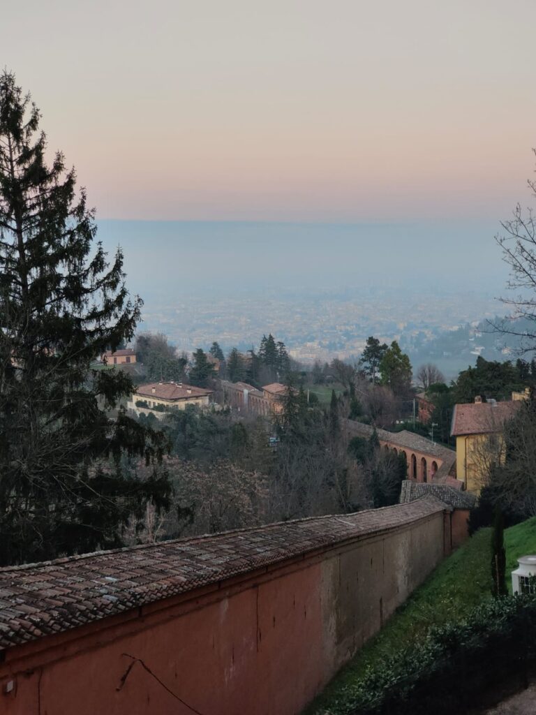
Perched on top of the mountain Colle della Guardia and overlooking the city of Bologna is the iconic ‘Sanctuary of the Madonna of San Luca’, an important symbol of the city. There has been a church in some form at the site since the 12th century with the current basilica built in the 18th century. Read on as I learn why San Luca is more than just a tourist destination, and as I discover, more by luck than by judgement, about the ‘Madonna and child’ and the symbolism of the longest portico in the world.

History of San Luca

Tradition has it that in the 11th century a pilgrim by the name of Theocles Kmnia arrived in Italy from Constantinople carrying a painting depicting the ‘Madonna and Child’. He was to take the painting to Monte della Guardia (a hill to the southwest of Bologna) but ended up in Rome. Thankfully a Bolognese senator was able to show him the right way. Theocles arrived at the gates of Bologna in 1160 and delivered the painting of ‘Madonna and Child’ to the then Bishop of Bologna, a Gerardo Grassi.

At the top of Monte della Guardia was a small church where Beatrice and Azzolina Guezi (two hermits leading a penitent life) took sanctuary. Bishop Grassi decided to deliver the painting to this church. Thus, the route that pilgrims still take to this day was born.

Over time a large influx of pilgrims visited the church which meant that it needed to expand to cope with the increased numbers. So, in 1194 the foundation stone, which came from Rome, was laid and blessed by Pope Celestine III. Since then, the church has had many transformations. Construction of the church as seen today was started in 1723 by Carlo Francesco Dutti and finished in 1757.

The Church

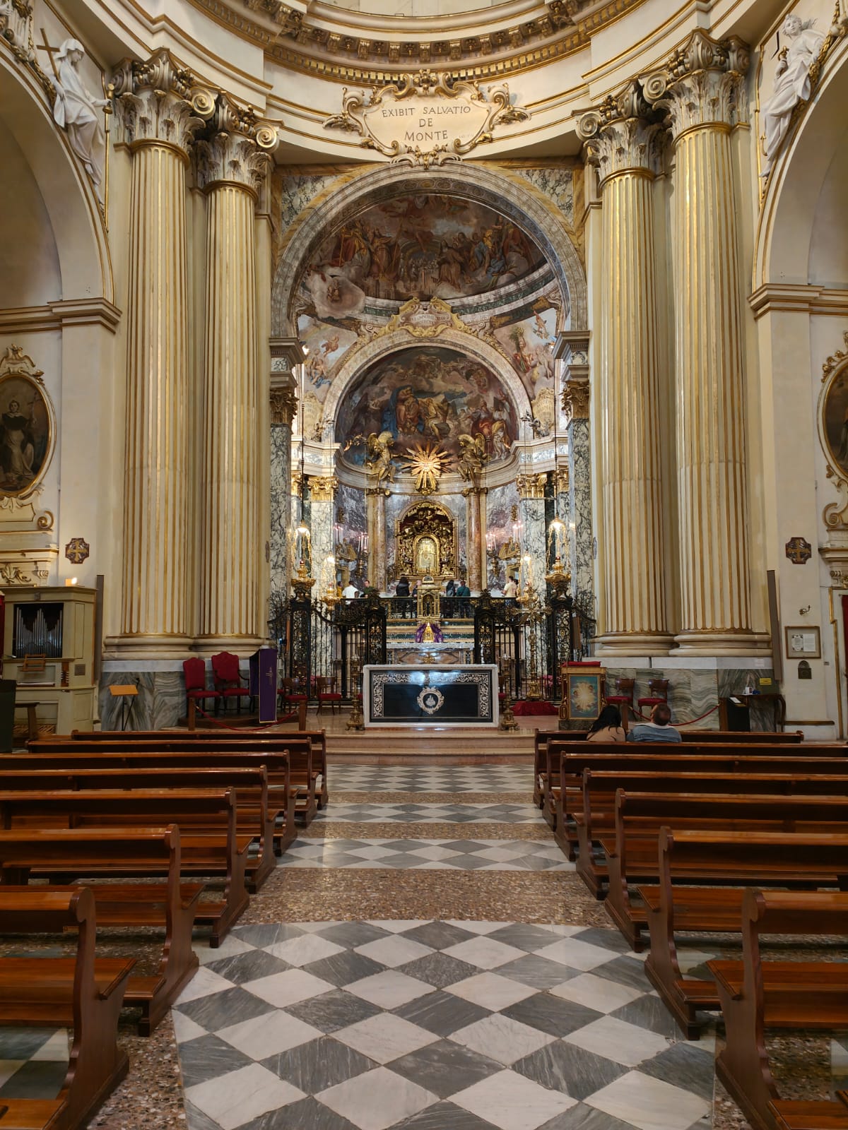
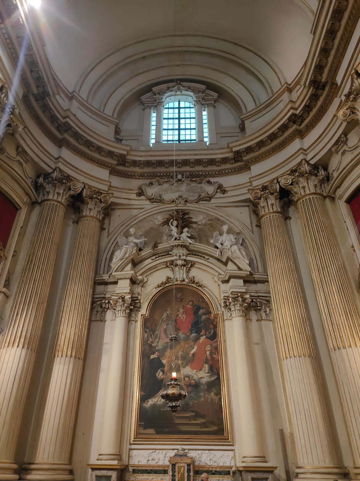
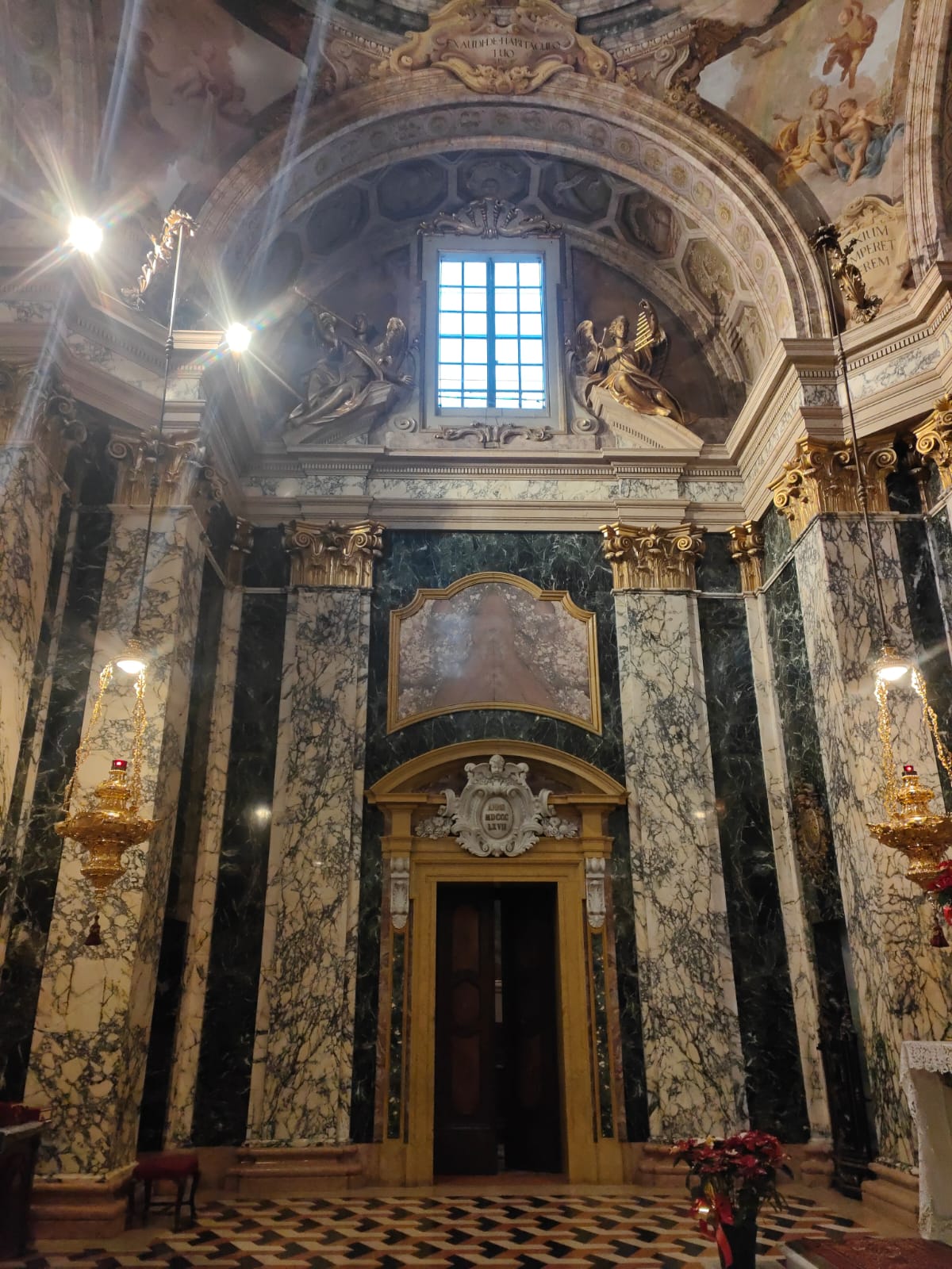
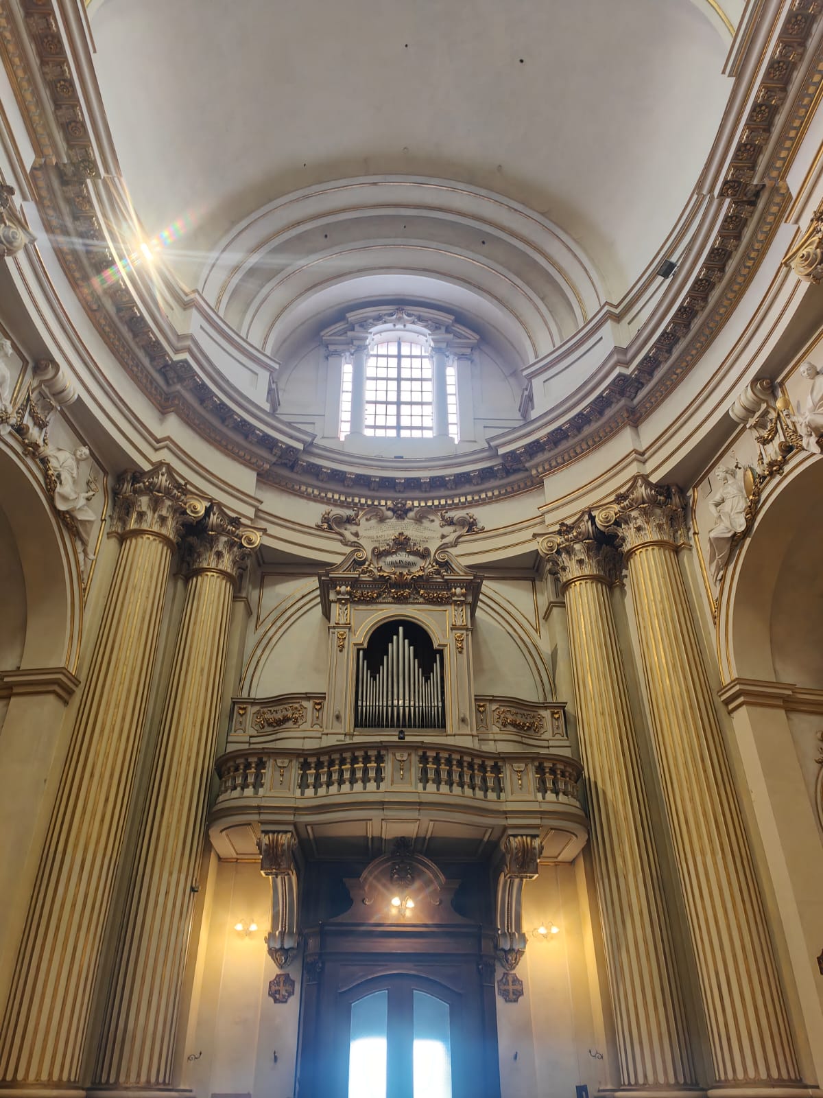
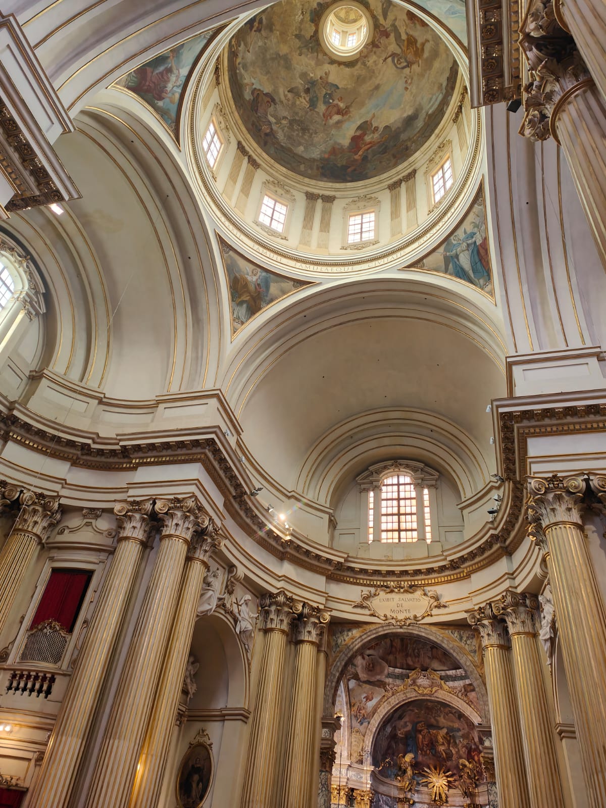
The basilica is prominent and spectacular being built on top of the hill. It is captivating, looks very Bolognese – plain and simple – basic in its external decor (orange in colour), and with a distinctive dome on top. As I walk in, I’m immediately drawn to the altar at the far end. Unknown to me, this is where ‘Madonna and Child’ is kept.

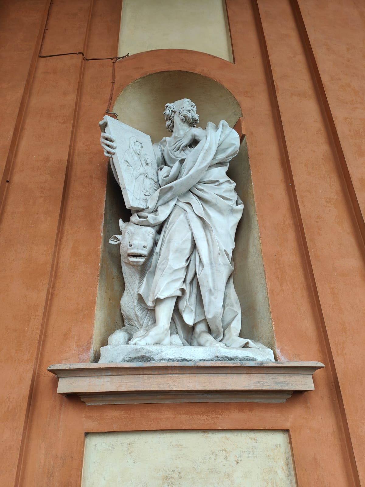
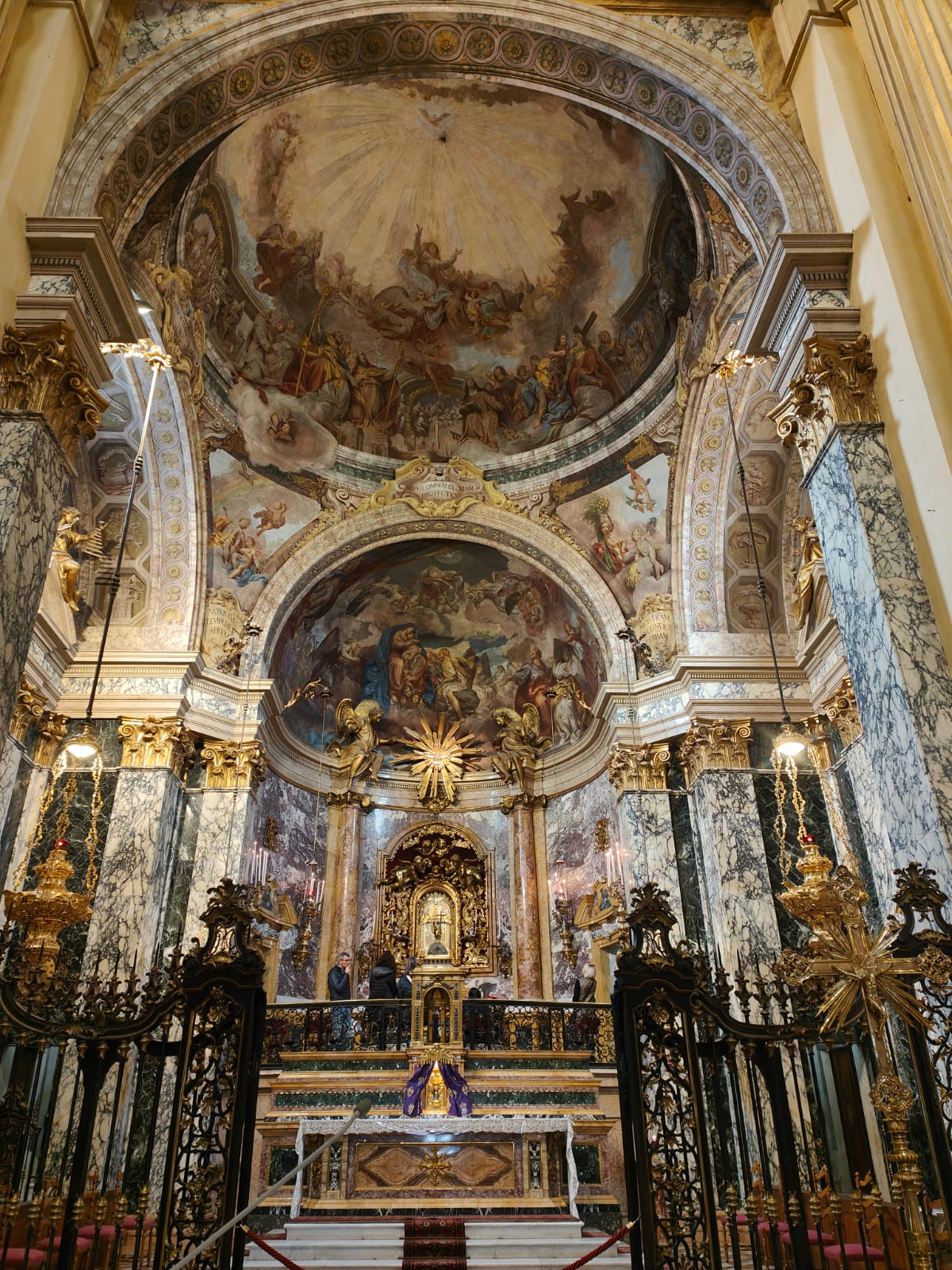
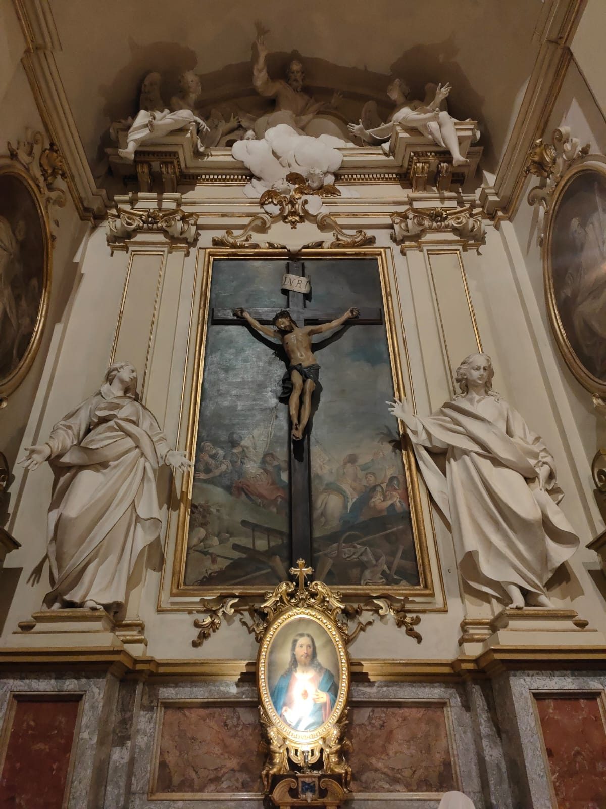
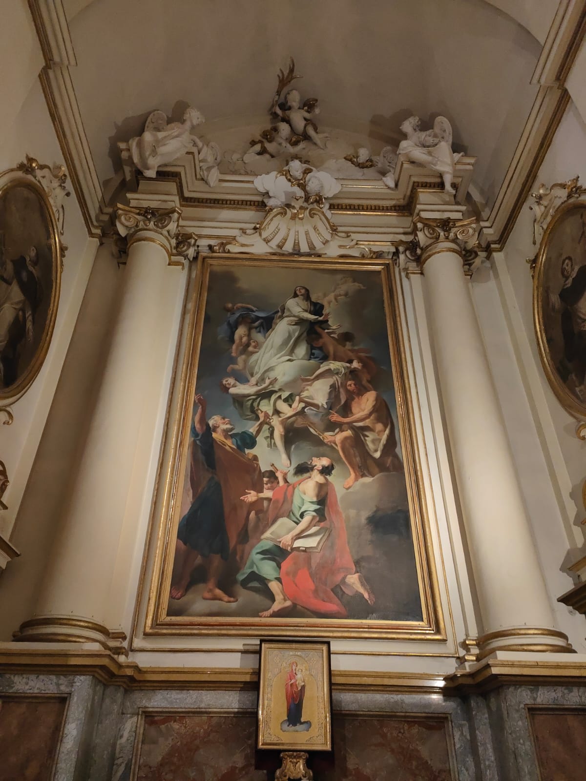
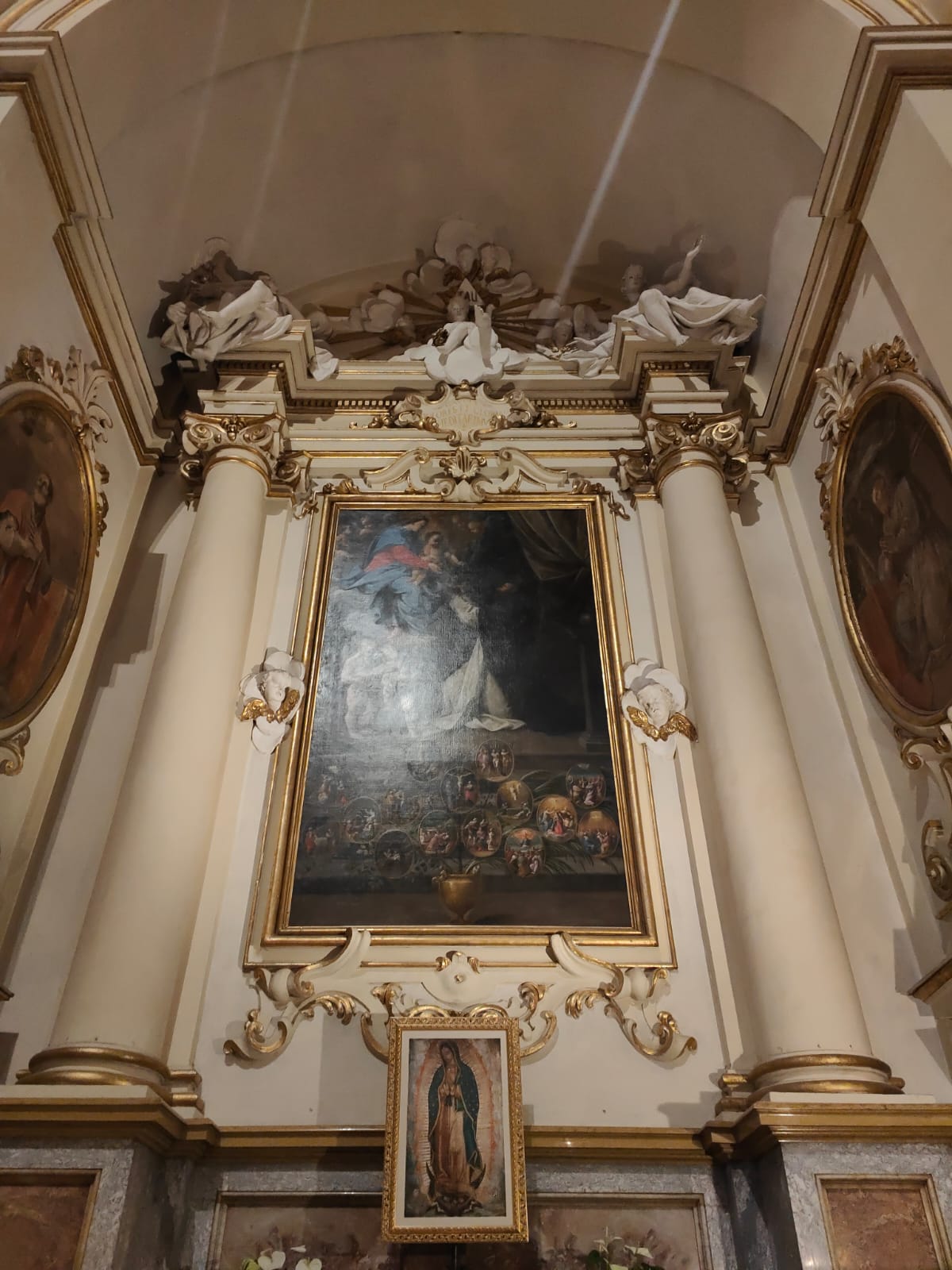
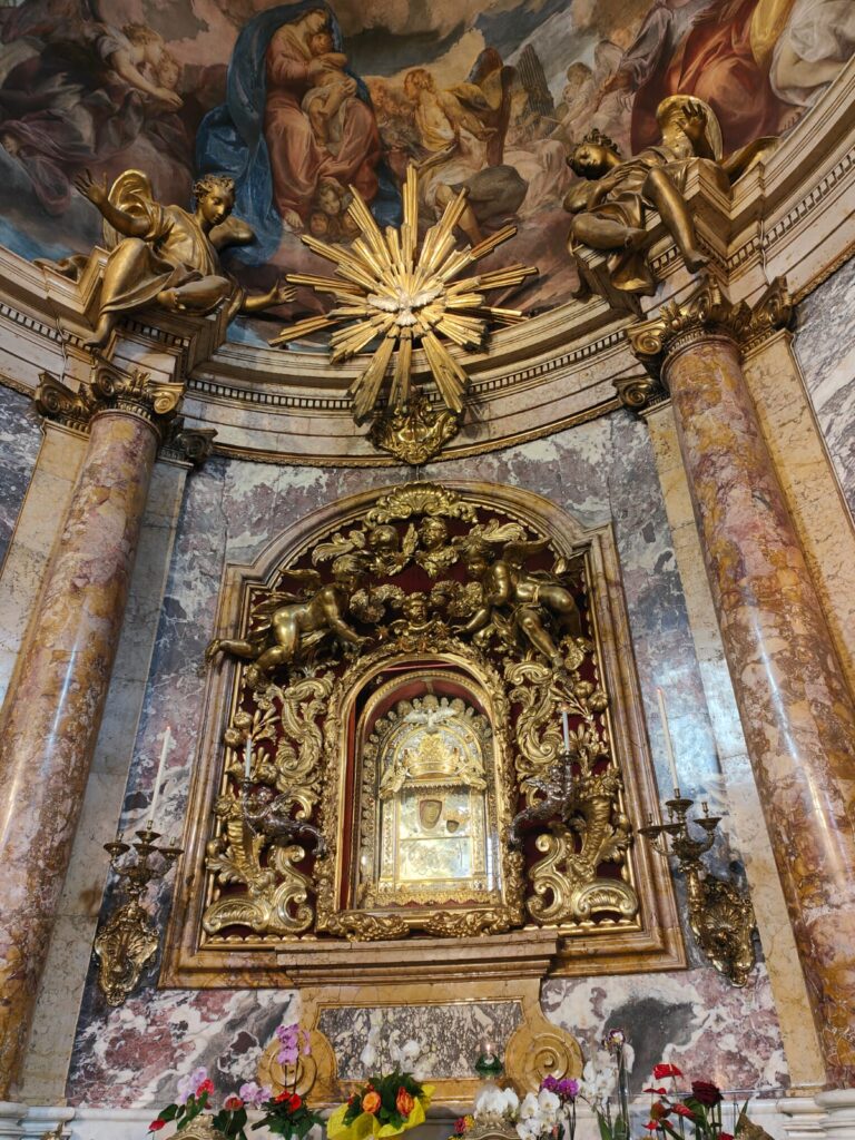
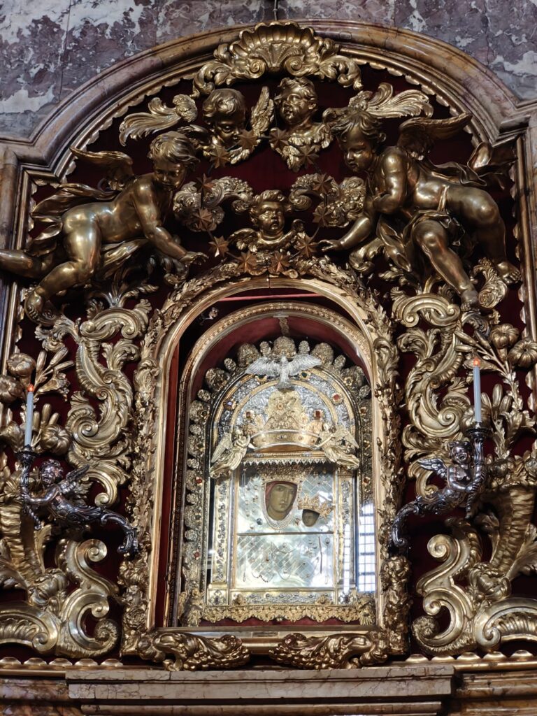
One soon realises the importance, grandeur and splendour of the altar area. Artwork, pillars, golden decorations adorn this area of the church. One cannot ignore the centrepiece, ‘The Madonna of San Luca’, which is kept in a silver looking case which sits in an ornate cove and is surrounded by golden borders. Also, inside the church it is possible to see works from Guido Reni, Donato Creti, Giuseppe Mazza and Guercino.

The Rains of 1433

In 1443 the heavy rains threatened to destroy the cities harvest. The city elders decided that that a procession from San Luca, carrying ‘The Madonna with Child’ to the centre of Bologna might help the situation. Miraculously, as the painting left San Luca so it began to stop raining. And so, since 1443 it has become tradition (feast of accession) to carry the painting down to the city where it resides in Bologna’s Cathedral for a 1 week before a procession takes it back. There were two occasions when this didn’t happen – firstly, in 1849 when the city was occupied by Austrians and, secondly, in 1944 during World War II.

The modern procession has broken a little from tradition as it now starts at Porta Saragozza and not San Luca and makes its way through the streets of the city to Bologna Cathedral.

The World’s Longest Portico

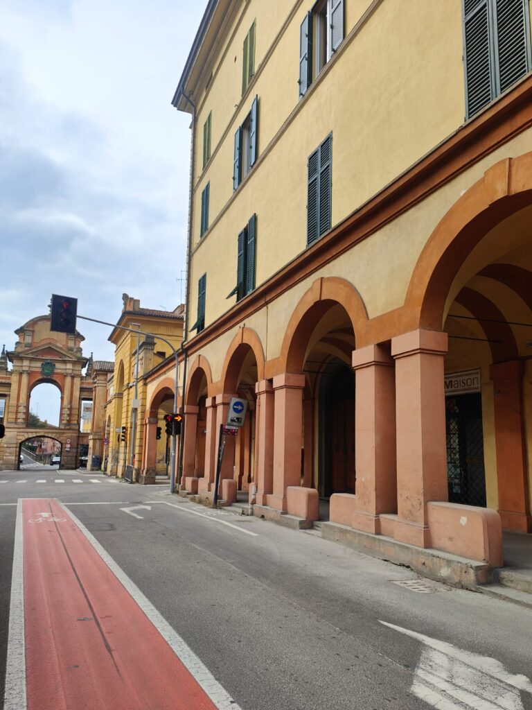
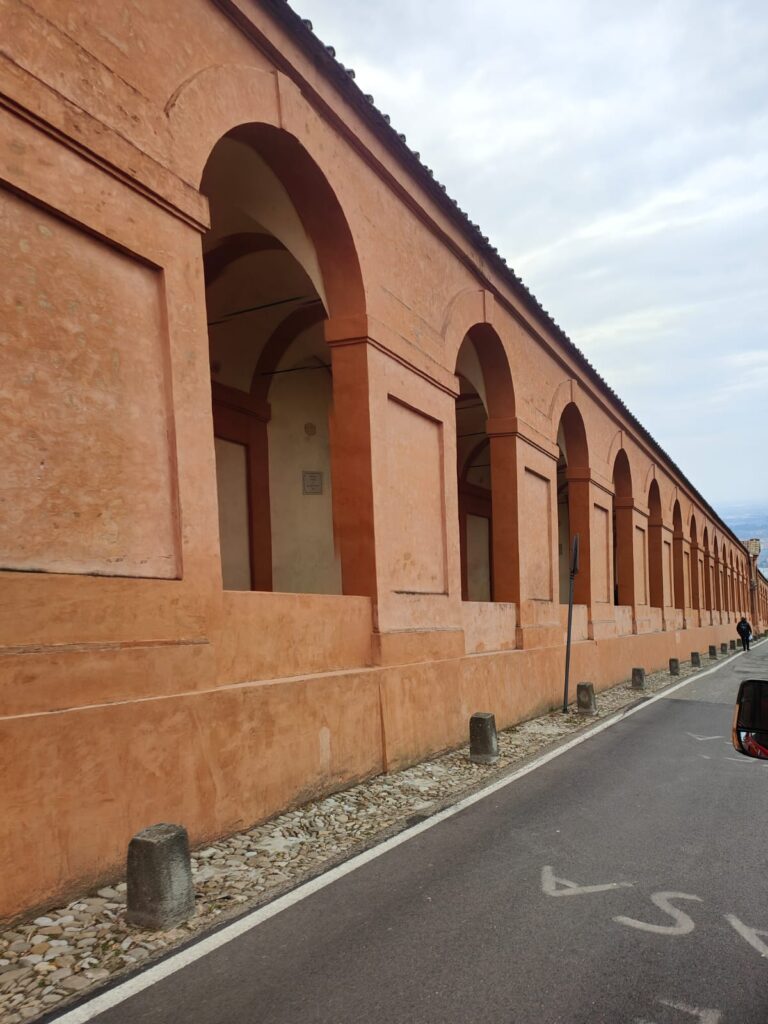
Built to protect pieces of artwork of the ‘Madonna and Child’ that had been created along the route, local merchants and wealthy families came together to provide the needed funds to build the portico. The world’s longest portico (covered walkway) was built between 1674 and 1793. The first arch starts at beginning of Via Saragozza, a street which leads away from the city at Porta Saragozza (gate of Saragozza).

The portico is made up of 666 arches and 15 chapels. The number of arches may be thought a very controversial number when you consider its religious significance (the number of evil and, some would say, the devil) but it is, in fact, by design. When looking from above the portico resembles a snake slithering up the hill to ‘meet’ the ‘Madonna’ church. The snake symbolises the devil and the church is seen as victorious and reigning supreme over the devil.

The length of the walk from bottom to top is 4km. For tourists and pilgrims alike, it is said that reaching the Sanctuary of the Madonna of San Luca by foot can make a wish come true.

Conclusions

The Sanctuary of the Madonna of San Luca should not be missed when visiting Bologna. Simple in appearance yet significantly symbolic, it is a pilgrimage site for believers, but also a very popular tourist destination. A portico plod may be inspiring though extremely exhausting, especially in the summer months. Reach the top, however, and there is great reward. This trip educated me on the ‘Madonna and Child’ and the significance it plays in the city of Bologna, and how it effects its traditions and its people. San Luca is a beautiful place of myth and mystery. 

Mauritius

Mauritius

Nestled secretly in the western part of the Indian ocean and to the east of Madagascar is the Mascarene Archipelago. The archipelago is named after Pedro Macarenas, a Portuguese explorer and navigator. He discovered the more famous of the 3 islands – Mauritius – with Reunion and Rodrigues Islands being the other two. He discovered it some 500 years ago and we decided to visit Mauritius for our honeymoon. Not only did we follow in his footsteps, but those of the Dutch, French and British people that came here. Exploration was limited but we saw what we could in our brief time on the island of Mauritius.

We found Mauritius a curious and fascinating place to visit, a sun kissed haven and most hospitable. Not only did Mauritius offer us a tropical beach escape, but the island also taught us some of its history. It clearly has had a troubled past but now it is thriving and is one of the most prosperous economies in Africa. Mauritius was uninhabited and deserted for most part of its existence until the 16th century when the Dutch settlers first arrived. For the next 4 centuries the Dutch, French and British took it in turns to colonise the island. I assume that the island was an important outpost, firstly, for explorers discovering previously unknown parts of the world and, secondly, for Indian trade with European companies.

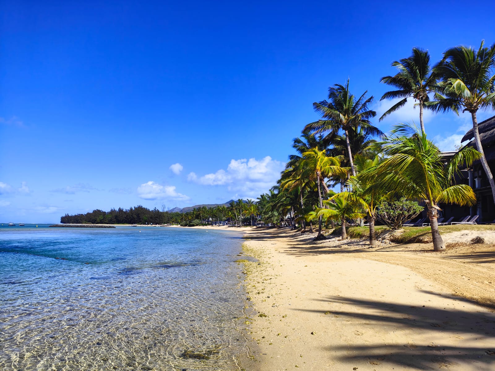
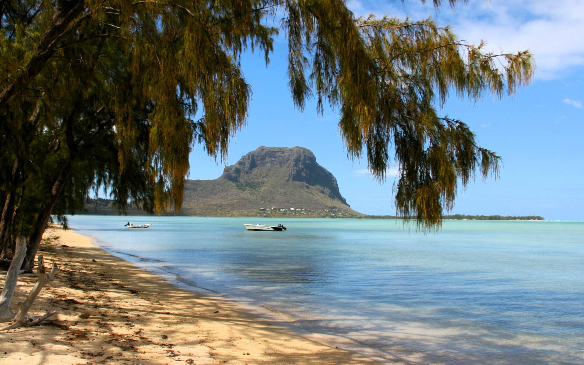
Mauritius is a pear-shaped, volcanic island which boasts over 350km of coastline.  Much of the island is surrounded by coral reef which protects the shallow lagoons and white sandy beaches. Mauritius is renowned as a honeymooner’s paradise with its pristine beaches, palm trees, turquoise waters and sumptuous resorts. We were lucky enough to stay at the Heritage Awali resort. This provided us with a base to explore the southwestern corner and west coast of the island with ease. With more time and perhaps with a little more daredevil spirit we could have ventured along the south coast and up the eastern side to the north of the island.


Dutch Occupation (1598-1710)
Our trip didn’t cover much, if any, of the island previously occupied by the Dutch. The Dutch arrived by chance and landed at Grand Port (southeastern corner of the island) in 1598 although colonisation didn’t fully start till 1638. Had we been a little more adventurous and gone to that corner of the island we would have seen evidence of their time on the island. The Dutch influence remains substantial in the fact that they brought sugar cane to the island, something that is seen wherever you go. The Frederik Hendrik Museum, and the Dutch First Landing memorial in Ferney would have provided us with a valuable education of the Dutch occupation. The Dutch named the island Mauritius in honour of Maurice of Nassau, Prince of Orange and stadtholder (a term we hadn’t encountered before but refers to leader in the Netherlands especially way back in the 16th century) of the United Provinces of the Netherlands.

French Occupation (1715-1810)
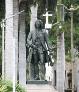
We learned about the French occupation through visits to the Botanic Garden and Port Louis. When the French arrived in 1715, they named the island ‘Isle de France’ and the Governor was François Mahé de La Bourdonnais. We learnt about him in both the Botanic garden and in the city of Port Louis. The French established the city of Port Louis as a naval base and ship building centre. Governor François built a lot of the country that we saw or explored on this trip – Port Louis itself, the government house in Port Louis and Chateau de Mon Plaisir in the Botanic Garden. Towards the end of the 17th century the island was claimed by the French crown whose administrative authority saw increased amounts of African slaves bought in and sugarcane established as a prosperous industry.


British occupation (1814-1968)
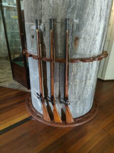
The British acquired the Island during the Napoleonic wars. They restored the name Mauritius and unusually allowed the customs, laws and language to remain French. Most of our education about the British occupation came from our trip to the Martello Tower Museum. There we witnessed the site of red coats, muskets and cannons.


The visit to Eureka mansion also assisted our learning process. This house was built by a British man. In 1835 the British brought about the abolition of slavery which brought much change to the island. As a result, a lot of indentured labourers from China, Comoros, Madagascar, Mozambique and Southeast Asia came to the island.

There were other sites that could have shown us more of the British rule had we had the time to visit them. One is the Aapravasi Ghat’s museum where we would have learned about indentured labourers during the nineteenth century. A visit to Cavendish Bridge (built by the British), Mahebourg seems a sensible trip.

We trust that these blogs have given an insight into this island’s short and fascinating history. Our day trips proved that Mauritius is a beautiful fusion of religion, food, colour, flavours, people and languages. For colours see the seven coloured earths of Chamarel. When travelling around the island it was difficult to make out the lie of the land, and Mauritius is still classified as a developing nation. Old and worn-down buildings mixed with modern and , to our way of thinking, ugly, new ones.

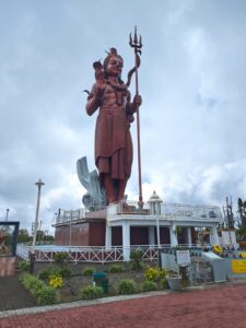
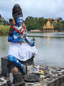
It is remarkable that on one corner there is a church and the next corner, a mosque. Religious statues sit alongside the roads or near beaches. The sacred lake at Grand Basin gives the visitor some idea of Hinduism. A significant pilgrimage site, the lake is surrounded by statues of their gods.


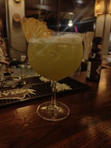
Mauritius is not all beaches and cocktails, (as much as we enjoyed that lifestyle), it is so much more than that. It’s where rivers and waterfalls flow and new acquaintances are made on daring activities or ambling around towns. We pushed ourselves out of our comfort zones and have created memories of a lifetime. Nature is a truly wonderful thing and one that we thoroughly enjoyed. According to Tripadvisor data Mauritius is the place to Honeymoon in 2025**! We certainly wouldn’t argue with that. We will leave you with the words of American writer and adventurer Mark Twain, “Mauritius was made first and then heaven, and heaven was copied after Mauritius”.
**Mauritius was recently voted by Tripadvisor data as the Honeymoon destination for 2025 (https://tripadvisor.mediaroom.com/2025-01-09-Tripadvisor-Reveals-2025s-Must-Visit-Destinations-Top-Picks-From-Travelers-Around-the-World) .

Benitiers Island

Benitiers Island

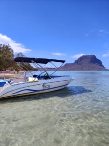
Our final trip within Mauritius was a visit to the uninhabited Benitiers Island. We contemplated several organised outings to Benitiers Island, but we opted for a full day excursion with Vitamin Sea Ltd. I must confess that I didn’t fully realise what the trip itinerary was when I booked. It is conceivable that I was distracted by our newfound, lazy, beach life. I listened to some advice to book with this company. Booking on a whim is not my usual modus operandi. As we talked with our new friends at the hotel bar on the eve of our final trip, we began to question why we needed to be up so early for a relaxing boat trip to Benitiers Island.

      Benitiers Island

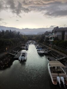
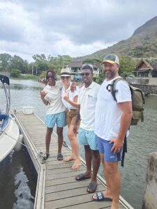
We arrived at the La Balise Marina around 0445!! Night was turning to day with every second that passed. Eerily peaceful, we were greeted by a Vitamin Sea representative. Customary paperwork completed, toilets visited, we were straight out on the jetty and climbing into our boat. Our crew (Brice & Whitney) were to look after us for our trip to Benitiers Island. We made a prompt departure. Obeying the speed restrictions, we followed a few other Vitamin Sea boats out of the marina. By the time we were clear of the marina, the sun was breaking through and lighting up the sky. We veered off to the north rather quickly. So much for our relaxing boat trip. Accelerator to the max it seemed we were in a rush for something. Nervously excited, we wondered what the rush was about.
We slowed down as we arrived to where other boats had gathered along with a group of kayaks (this was the same area where we had kayaked earlier in the trip). We were blessed to see a pod of spinner dolphins playing in the water. Our delight at seeing these playful mammals in their natural habitat was evident. As we were enjoying this special moment, Whitney started to talk to us about snorkeling equipment and kitting us out. Puzzled by the disruption to the display given by the dolphins, it soon became apparent she was preparing us so that we could go in the water and swim with them. We looked at each other in shock at what was happening. I mentioned at the beginning that I hadn’t fully read the itinerary. Lesson number 1 – read carefully before signing on the dotted line!! We had time to process the news and prepare for this monumental occasion as Brice said about heading south to find a better spot. Sit back, hold on, the morning sea breeze blowing through our hair (well, Hannah’s certainly, and mine, what’s left of it!!) as the accelerator was pushed to the full.

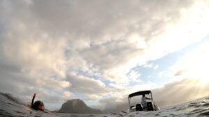
In just a short time our fast boat brought us south around to Morne Le Brabant (scene of our first trip within the trip) just as a rainbow appeared over the ocean. This area must be a magical spot for the dolphins (these ones were bottlenose) who approach the coast here to socialize, relax and play. The waves here were certainly bigger and the clouds had rolled in. We were told to sit on the back of the boat and, when instructed, to slide in. Masks and snorkels at the ready we spent the next couple of hours climbing in and out of the boat as we tried to keep up with the dolphins that were swimming all around us.


What…an…experience!! We politely slipped in and out of their world, the cold water not being a problem. Beauty was all around us, and our fears and anxiety immediately dissipated to be replaced with high levels of adrenaline. I must have read the bit on the Vitamin Sea blurb that says, ‘Life is about collecting experiences that take your breath away’. Well, this was certainly one of them! We were blissfully unaware of time (it didn’t seem to exist), but all good things must come to an end. By the time we left, we were exhausted. Mouths filled with salty water (we weren’t the best snorkelers), hearts pumping, tiredness in our eyes, but excitement pouring out of us. We had such a smile on each other’s face that could not be wiped off. We collapsed into our seats again as we went back the way we came and towards Le Morne. We thought that was the end of our snorkeling until Brice shouted out, “Sea turtle!” We still can’t believe how he was able to see this creature beautifully camouflaged in the reef. He brought the boat to a stop and allowed us to swim around with said creature. He/she was completely unfazed by our presence. We finally left the turtle to enjoy its surroundings, and we made our way a little further up the coast where we dropped anchor.

Turtle  

This was where we were to do the snorkeling that I remember being told about in the booking process. As we slid into the water the number of fish that greeted us was surreal! All sorts of fish of different shapes and colours swam around us. We mustered what energy we had left to swim around admiring these colourful creatures. The azure waters, coral reef and pristine sands were the perfect back drop to the array of colour. Hannah managed to stay in longer than I did as I was worn out. The adrenaline of the previous moments had left me, and the borrowed kit was starting to hurt. Hannah eventually decided that she had seen enough and got back on board. We then made a slow and leisurely trip towards Benitiers Island which passed through the lagoon near Crystal Rock.

   Benitiers Island

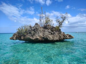
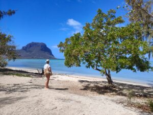
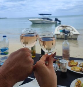
Crystal Rock is a geological curiosity. Rising majestically out of the water, like a large crystal sitting on the surface, it certainly draws a crowd. The rock is a photographer’s dream. The rugged rock, crystal clear waters, blue skies, white puffy clouds create the perfect picture postcard shot. We circled it a couple of times to capture ‘the money shot’, before heading to Benitiers island and an eagerly anticipated lunch. The boat stopped close to the seashore, and we disembarked and walked through the low levels of water to the beach. Whitney and Brice assisted with the BBQ whilst we took a moment to stroll along the beach, all the while taking time to realise what an incredible morning that we had just experienced. Our 4 o’clock wakeup call had been completely forgotten about. We savoured the moment, just the two of us, hand in hand, walking in the sand. Splish, splash as we walked along the pristine sands and not a care in the world. No better feeling than sand between our toes. We reached the end of the isle, where Morne Le Brabant seemed to look at us. We said to each other, rather proudly, that we had conquered that mountain. We turned back, slowly realizing that the end of the trip was nigh – all good things, etc… We got back to the part of the beach where the smell of the BBQ of marinated meat and fish filled the air. We sat back and enjoyed a glass of wine watching our boat bob with the slight waves in front of us.


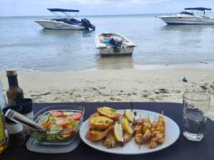
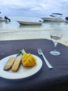
Dinner was served – a homemade Mauritian barbecue that included fresh fish, shrimp skewers, chicken, garlic bread and salad. Hats off to the chef – this was BBQ brilliance. I’ve certainly stepped out of my comfort zone in tasting and eating fish this holiday. This is something I may continue when I’m back home – we shall see! The meal finished off with grilled banana flambé straight off the grill. Again, all good things, etc…. We jumped back on the boat, said goodbye to Benitiers Island before Brice put the accelerator to max again. Brice got the music pumping as we sped our way back to the marina. It was with sadness that we had to say goodbye to Brice and Whitney (they were great representatives of Vitamin Sea), but we left with memories of a lifetime.

Vitmain Sea Ltd Crew

Île aux Bénitiers, La Gaulette VCA, Black River, Mauritius

Port Louis

Port Louis is a fascinating place but our visit was far too brief and we only gained a small snapshot of the city. This was our penultimate outing in Mauritius but Port Louis is the  capital city and it may have been an error to visit for such a short time since it is full of interest. Now that I’m home and have spent much time reading, researching and learning about the places that I visited (hopefully to educate myself and my followers). I write this with a certain amount of regret for not making the trip to the capital a full day. We live and learn.

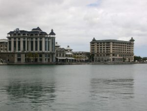
Enough of what could have been! We arrived into Port Louis to light rain and parked in what appeared to be a modern car park near Caudan Waterfront. How many capital cities in the world would you be able to park right in its heart, free of charge and with ease? Leaving the car, we walked unknowingly around the back of the Blue Penny Museum which is dedicated to the history and art of Mauritius.


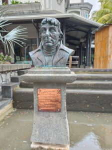
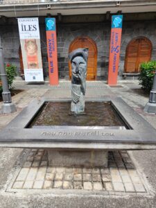
Directly opposite the museum was a bust of Nicholas Baudin, funnily enough a Frenchman, a cartographic surveyor and naturalist (research reveals that he died on the island on his return from exploring and surveying the coast of Australia).


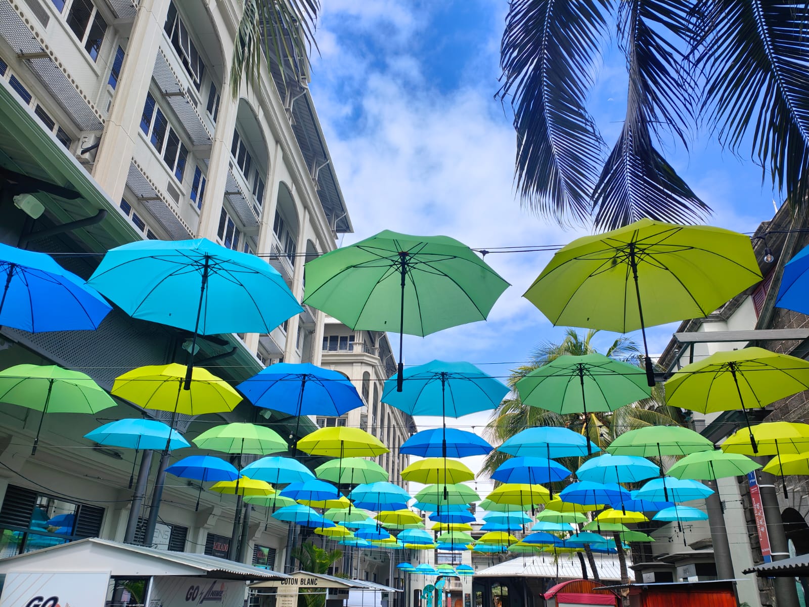
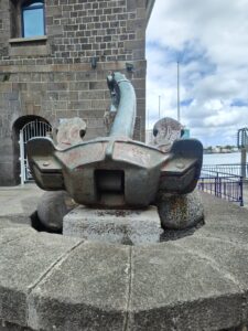
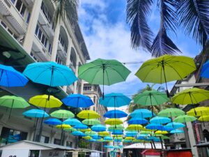
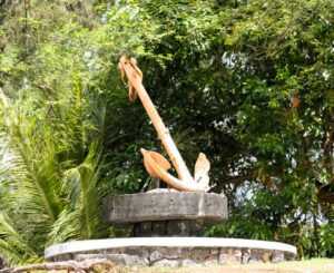
As we continued our stroll, we left the museum behind us and walked under a canopy of colour. This came from several colourful hanging umbrellas.  This looked like evidence of investment that had taken part in this part of Port Louis – a modern feel of entertainment, with shopping stores and eateries for the masses. The vibes were of a feel of a hangover as slowly but surely everything was springing into life. As we left the shopping precinct we passed a large anchor – a reminder of the city’s shipbuilding past.

Port Louis   

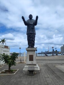
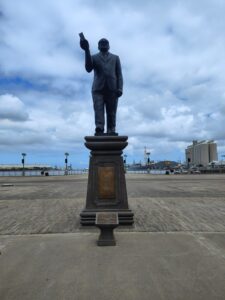
Shopping precincts are, to us, boring at the best of times and we were glad to reach the harbour’s edge. We walked a while but this was soulless and barely a boat to see except for a large military ship looking old and retired yet dominating the view. This was very surprising considering the country has no military force. As we turned away to look towards the rest of Port Louis we saw 3 statues. Our driver informed us that one was Sir Seewoosagur Ramgoolam (see the blog on the Botanic Gardens). The other two have been researched since coming home and only then to realise that they were huge characters in modern Mauritius. Is this the reason for the three statues being together in one square? The other statues were of Sir Aneerod Jugnauth (affectionately known as SAJ, a former President and Prime minster of Mauritius, who considerably shaped the economic and political contours of modern Mauritius) and Professor Basdeo Bissoondoyal (a Mauritian social worker who played an important role in pre-independence politics. He was a man of knowledge, discipline and perseverance and is portrayed as a beacon of hope for the common people).


Leaving these statues we headed towards the underground walkway. As we were just about to go down the steps when the Mauritius Postal Museum was pointed out to us.


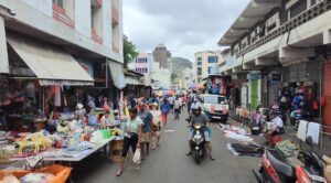
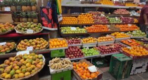
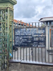
Sadly, this was passed by with speed as we made our way towards to the central market. As we stepped into the vibrant and bustling indoor market, we were aware of the bright colours of fresh food and the smells of spices on sale.  Their rich aromas spread through the air tantalising our taste buds. Some stall keepers stood proudly hoping you would buy their produce, while others engaged in conversation with associates and there were plenty who were busily doing their much needed transactions. This all created a wonderful hullabaloo. We left the market by a different entrance and stopped at a few stalls selling some touristy bits which we picked up.


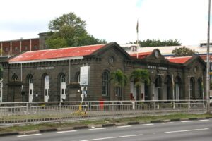
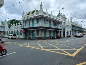
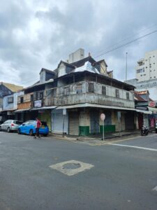
After our saunter in the market, we walked some of the local roads nearby before we retraced our steps back towards the Caudan waterfront. Along the way we passed some points of interest which included the entrance to Chinatown (I’ve never understood the fascination with these, common as they are in most cities these days) and the historic Jummah Masjid Mosque (oldest and first mosque built on the island – we didn’t know what we were looking at really so passed through quickly) and several colonial buildings. One of the colonial buildings in particular stood out, as it looked for all the world like “tin foil” had been used to repair a section of the roof. We returned back through what were now bustling streets surrounding the central market and past the main bus station. Lots of rickety, colourful old buses lined up ready to take locals to all various parts of the island. This is always a sight to behold and always action packed.

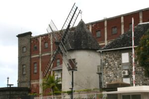
We picked up the underground bypass again and came out by the Postal Museum again. Before walking behind it to see the Port Louis Port Police building, we noticed a rather odd structure. Tucked away in between some modern buildings was a random windmill and it looked quite incongruous but fascinating. Puzzled by this building, I made sure that it was something that was researched when time allowed (windmills were built to assist the agriculture industry on the island and in 1999 this one was converted to a museum), and definitely would not be ignored next time we visit.


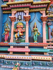
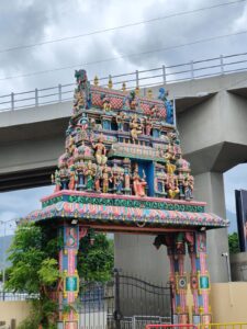
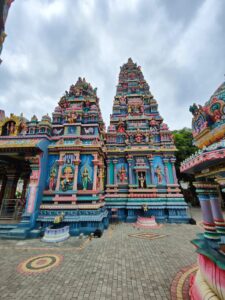
We had places to be so we left the windmill and hastily returned to the car via the Caudan waterfront. As we retraced our steps we passed the 3 statues though this time from a different angle. This meant that we noticed yet another statue behind them on the other side of the main road. This was the statue of Bertrand-François Mahé de La Bourdonnais (see Botanic Garden blog). His relevance not yet known he was sadly ignored, apart from a long range shot on the camera. His statue is located at the end Place d’Armes, which leads to Government house. We made our way back to the car jumped in and left for our next destination. I did make sure that we stopped at the Madurai Mariamen Temple.


Back to the regret thing. Research ahead of the whole trip makes sense. We missed the two cathedrals, the Champ de Mars (oldest horse racing track in the southern hemisphere), Fort Adelaide, Aapravasi Ghat World Heritage Site, hikes and viewpoints of Port Louis and countless museums. There’s loads to see and enjoy. Time beats you on occasions and opportunities aren’t grabbed. Let’s hope opportunities aren’t spurned in the future, and life will provide us with another chance…

Port Louis, Mauritius

House of 109 doors

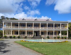
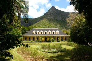
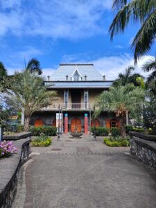
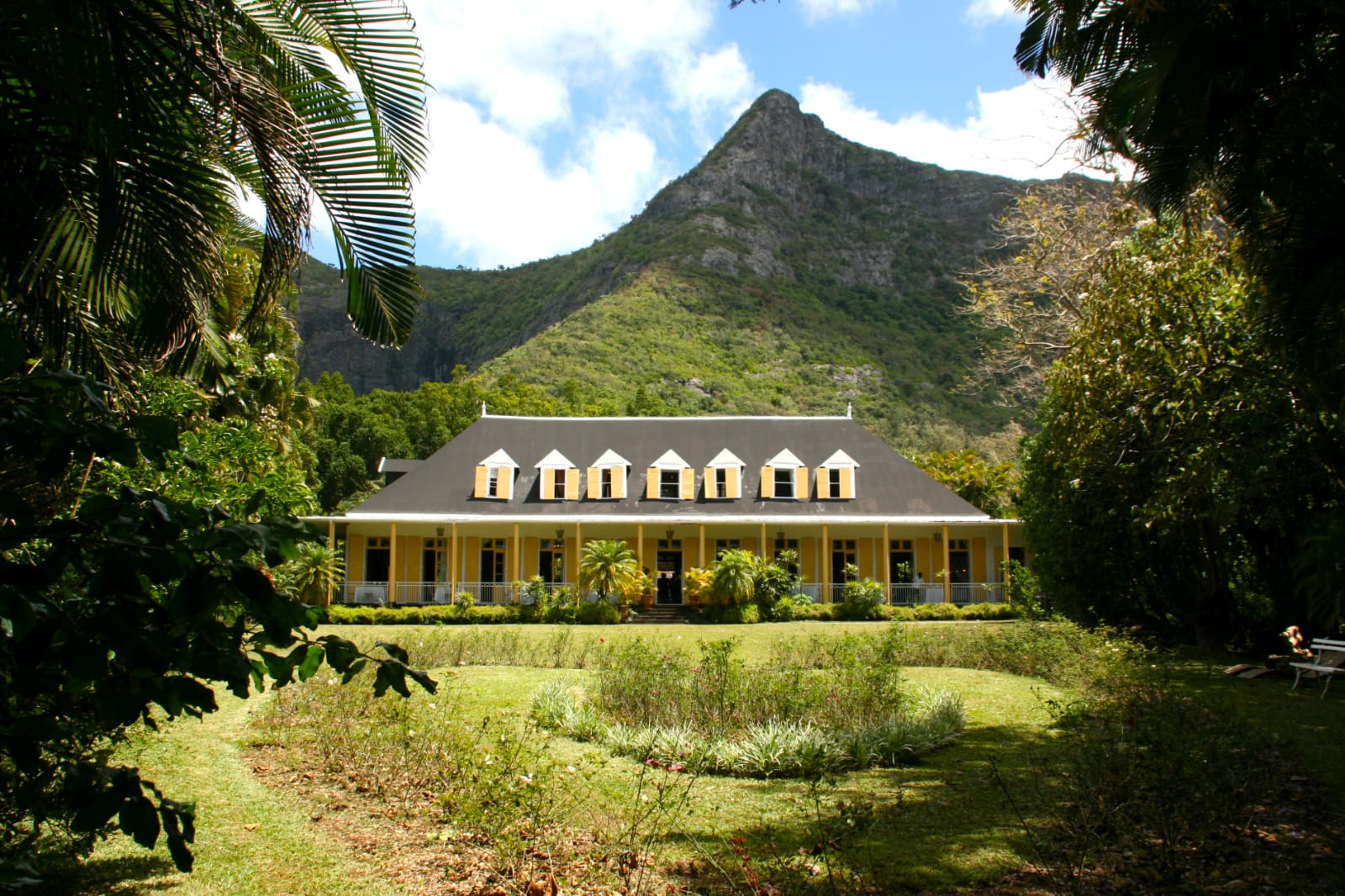
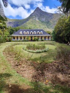
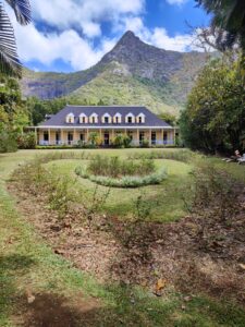
I feel there is no better place than the house of 109 doors, (Eureka Mansion for its formal name) to delve into the fascinating colonial history of Mauritius. Mauritius was claimed by France in 1715 and was administered by the French East India Company. The French government took control in 1767. In 1810 the island was captured by the British during the Napoleonic Wars. In the last blog we looked at how the British built their defences and this creole house was built in 1830 between the Moka river and Mount Ory. The house is perfectly sheltered among the local trees, and sits beneath the Mount which provides the most stunning back drop to this picturesque, colonial house (as I think you would agree from the pictures).

House of 109 doors

It was built by Mr. Carr, a British aristocrat, who wanted to be close to ‘Le Réduit’ (the Governor’s house – which is now, coincidently, home of the President of Mauritius). I’m led to believe that it was then sold to Mr & Mrs Robinson via an intermediary family before the Robinsons sold it in 1856 to Eugène Le Clézio. I must admit to being a little bit confused over these next stages of its history, so hopefully I have got this right. I believe that Eugène was the eldest son of François Alexis Le Clézio. When François visited the island and discovered the home, it was the home of his dreams and said Eureka! (reference Archimedes’ exclamation Eureka!). This family would remain owners of the house for the next 120 years. The family was to build its wealth on the island’s sugar industry. The house passed through the generations before finally being sold to 2 real estate agents in 1975. They only kept it for two months before Jacques Planteau de Maroussem and his in-laws bought it. Jacques’ mother-in-law was a grandchild of Sir Henry Le Clézio (son of Eugène) so the house was in family ownership once more.


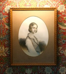
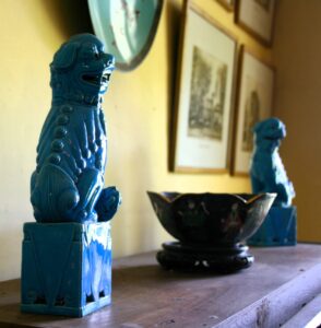
The house was built completely out of wood. It is now a museum and provides a fascinating insight into 19th century Mauritius and the country’s plantation past. It certainly is a masterpiece of tropical construction. It is a real beauty to behold (look at that picture with the mountain behind the house). It was built using local ebony and mahogany wood and with some of the structural beams are made of tambalacoque wood (the seeds of this tree were eaten by the dodo). Two verandas were constructed. One points to the north (for the winter) and one to the south (for the summer). It is through the northern veranda that entrance to the house is made. As we walked into it we immediately felt like we had stepped back in time. Fine furniture and curious antiques were in each of the ground floor rooms. Particular sights of interest were an antique gramophone, and old camera and a piano (remembering my youth when lessons were regular, and I wish I hadn’t stopped playing) where we duly sat for a customary tourist photo. There was no kitchen in the house as it was made out of wood. This was a good design feature as this separate building was only a short way from the main house – fire prevention I guess.


We finally dragged ourselves out of the house to explore the grounds and gardens. Sprawling out in front of the southern porch was a lush green lawn which narrowed off at the far end. To the left was a secluded pathway that took you to the end of the garden. At the end of the path, there was a little area where we turned around to look back at that incredible view. Beautiful. Stunning location. The sun peeking through the clouds lit up this wonderful house, some of the 109 doors and windows gleaming like laser beacons at us. The small, planted area at the bottom of the garden looked like it had been constructed in the shape of a heart.

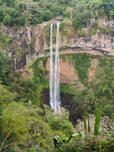
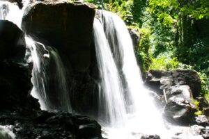
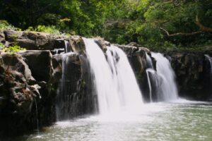
We left this dreamy Mauritian view and continued to follow the path. The path was to lead to the famous waterfalls that formed part of the estate. The path did change to a steep and uneven route which passed through Mauritian flora and fauna. Not being an expert on this, it was of little interest apart from providing shade from the beating sun. Along the way there was a sign that I’ve read before but is always a poignant reminder of the need to look nature. “Kill nothing but time. Leave only footprints. Take only pictures”. When we reached the bottom of our climb, we found 3 fine waterfalls but the fourth one didn’t look that impressive. We could have spent longer enjoying the therapeutic sounds of flowing water and bird song, but we were keen to see so much more so we walked quickly between the waterfalls before making the climb back the way we came. The heat certainly made harder work of the route, but we got back to the house invigorated but exhausted, hot and sweaty and in desperate need of a drink. We duly supported the local café/kitchen by buying a couple of drinks. We sat out on the northern porch and took a moment to ourselves before heading back to our patient driver who waited in the car for us. Join us as we move onto our next stop of this island.


Maison Eureka, Mount Ory Road, Eureka, Mount Ory, Moka VCA, East, Moka, 80825, Mauritius

Martello Tower Museum

Leaving behind the physical and fun activities, it was now time to vary our excursions to do some educational exploration. We could have been daring and hired a car to explore the island but in holiday/honeymoon mode we were content with using a local taxi man (Jay) to drive us around and take a more laid-back approach. Jay was a recommendation from a fellow guest (they having used him on a taxi journey) and worked out a lot cheaper than booking through an online company or our hotel. This is clear evidence of the value of meeting and talking with people and not always relying on the internet – as if evidence were needed!! The internet has its uses but social media has changed the way we communicate, and that not for the better. Face to face communication is a dying art and its future doesn’t look bright based on the teens and twenties we see. We booked two day trips with Jay and split these into a day meandering into the north of the island and a day meandering around the middle and southern part of the island. After a few exchanged WhatsApp messages (the internet has its uses!!), we agreed on some places to visit one of which was the Martello Tower Museum.

Martello Tower Martello Tower

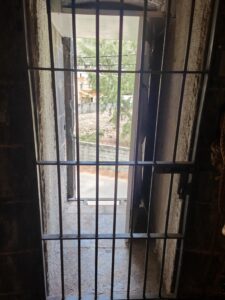
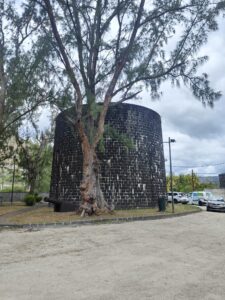
The first place I want to write about was the Martello tower. Our taxi was a smart Suzuki. Most cars we observed on our meanderings were modern and the roads on which we travelled were of good condition. We left the main road/highway before turning into the local housing, wondering where we might be headed. Jay was quick to point out a random sign saying that it was the right way. We parked up in what looked like a normal public car park – like we have back home. Directly in front of us was a mound and to the rear of us the tower. It was clear to see that the car park was ‘overseen’ by a short and stumpy tower. The addition of the car park meant that he local landscape was a lot different now compared to the time when the tower was built. We left the car immediately and made a beeline for the entrance to the Martello Tower. A little puzzled and amused at the need to rush in, all became clear. We quickly walked in and handed over the a pittance of an entry fee. The lady behind the counter, registered our visit before she went to the entrance and brought the prison cell like door shut and locked it up. Fearing an ambush/capture we were quickly put at ease when our driver (who accompanied us on the tour) explained that we were on a private tour and that we wouldn’t be disrupted as the door was locked. We quickly relaxed into the informative chat provided to us by our guide.

It is evident there has been some serious love, care and investment put into the restoration of this building. It shows an important past in the island’s history. Personally, I always find these places fascinating. I always try to visit anything that is British when on my meanderings. It was amazing to see how vast the British empire extended at its height. Was it not the largest empire known to man? A quarter of the world’s land area ‘belonged’ (there is a debate to be enjoyed about the use of this word!!) to the British back in 1913. Flights have made travel so much quicker and easier, but when the British captured these lands, it would have been some boat journey here.

When the British captured the island, they decided to build 5 Martello towers along the west coast in strategic locations near to river mouths as part of the coastal defence against a French invasion. At the time the French weren’t too happy with the British plans to abolish slavery. Building of the Martello Towers started in 1832 and were completed in just 3 years. This was just a couple of years before Queen Victoria came to the throne in 1837. The British based the Martello towers’ design on a tower they had been impressed with during a conflict against the French during a fierce battle at Mortella Bay, Corsica. The Brits were so impressed by these structures that they took them to all parts of the empire to aid its protection. The 5 Martello towers in Mauritius were never to see any military action.

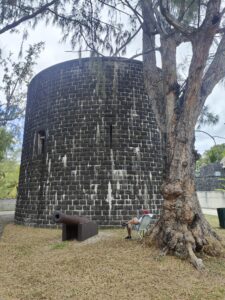
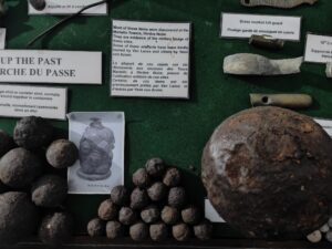
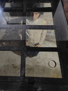
Our guide was based on the current “entrance” level (I believe that this wasn’t the original entrance level). When we walked into the Martello Tower it was noticeable how thick the walls were. Some were 11 feet thick! The tower was built using basalt rock. Beneath this entrance level (which I will refer to as ground level), was a fascinating design. Underneath the floor we walked on was where the water was stored. Whether it was the Brits or an idea they had pinched, they managed to design a system that harvested the rainwater captured on the roof and then was stored beneath them. Our guide was quick to pull on a device which showed us the water still stowed beneath us through a glass viewing point. The entrance floor our guide was on would have housed the powder magazine. She showed us some of the ammunition types that would have been stored here on this level.


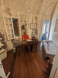
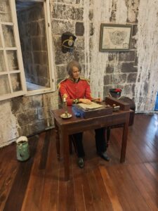
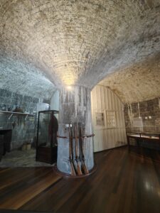
Our guide then took us up some stairs to the first floor, and as we entered it an impressive fan vault ceiling was seen. It was surprising to see this in a bright, white colour. This was the area where the soldiers would have lived and slept and where the original entrance was. The captain/general in charge had their own area constructed out of timber. This had been carefully restored to display a captain writing at his desk. Around the middle were several muskets and a cannon ball where you could try and guess the weight. My guess was hopelessly wrong. If you are ever there, take a close look at the ceiling as you can see the stalactites forming.


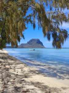
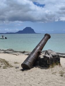
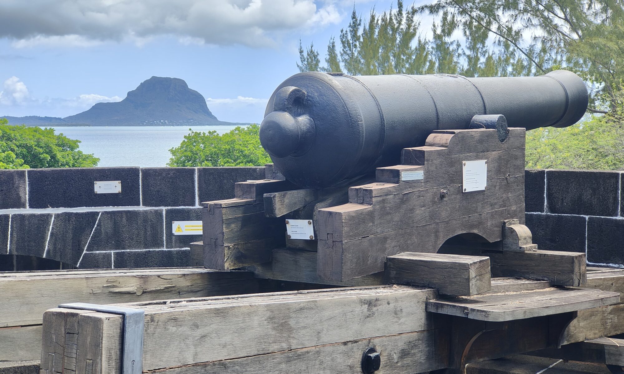
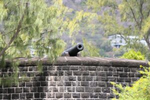
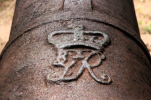
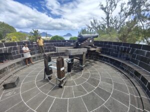
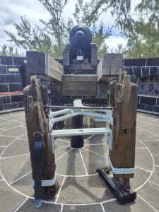
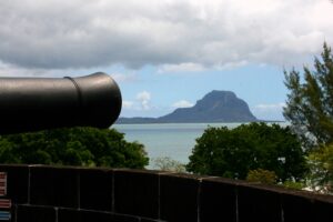
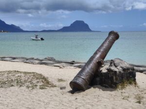
We left the digs (first floor) and made our way to the final floor, which was the roof. As we came out onto the roof of the Martello Tower, the original cannon was set up in place, and it had been lovingly restored. Our guide was able to explain how it gave the small garrison a 360-degree shot. It now resided pointing out to sea. In the distance was Morne Le Brabant. It certainly was a dreamy view for us (not surprising considering our walk up that famous mountain), but you could see the strategic view from back in the day. Standing there one could dream of a tall ship waiting in the bay to invade or bring supplies. Sadly, it was all rather peaceful.

This completed the end of our tour of Martello Tower. It was quick. I couldn’t fully listen partly due to the fact it was hard to understand everything that was said (there were some language barriers which made it hard to understand). Some online research was needed to help write this blog and assist with the education, however, we thoroughly enjoyed our visit to the tower and used the internet to compound what knowledge we acquired on the day!! We certainly learned a lot and would recommend it to anyone else who is visiting this wonderful island.

   Martello Tower  

Tamarind Falls

The third and final part of our Mauritian adventures with Yanature (the tour company), was a half-day hike to the Tamarind Falls, also known as the 7 cascades. A must do apparently for anyone visiting the shores. Again, we had organised transport to pick us up from the hotel. We had a later pick up on this morning which was greatly appreciated! It meant we could enjoy breakfast before leaving.

The first hiccup of this trip occurred when we walked out, a taxi driver ushered us to jump in and he drove off hastily, clearly working to a tight time schedule. Half asleep we naively just followed him. Not until he left the complex did he and we realise that we weren’t the right guests for him to pick up, and he had to make a quick and embarrassing U-turn and return us to reception where our taxi was waiting. We quickly changed over before leaving for a second time. We then made the rather peaceful journey, inland and north of where we were staying.

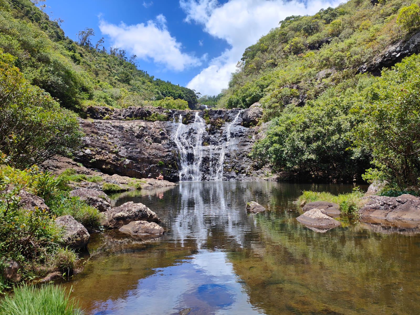
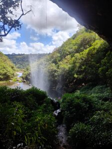
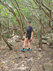
On our arrival we were greeted by our hero Rowin, our guide from our first “hike”. Our mix up before we left meant we were the last to arrive, and this time we weren’t so lucky as to have our own personal tour. We were to be accompanied by two couples from Czechoslovakia, making us a group of 6 plus Rowin. We were dropped off on some fairly flat ground and on the edge of some sugar cane fields, we made our way around the edge of the crops. As we progressed, Rowin said that we were to take the small gap in the trees. Clearly this was a gap with which he was well acquainted. He had warned us that this hike wouldn’t be as difficult or technical as the mountain one which meant we were in relaxed spirits. We then started the descent down a steep track, using the trees, branches, roots and anything else we could lay our hands on for support (these would have been great on our first hike). Our hike was to navigate and see 5 of the cascades on the river Tamarin (see the second Mauritian second blog). Had we done the full day hike we would have seen all 7.

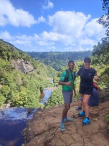
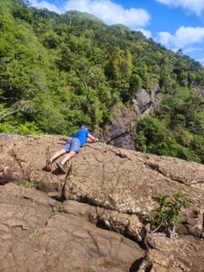
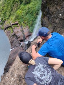
We arrived at the top of what was the second cascade, and clearly the highest point of the river we were to see. The area a hub of activity, as different tours were setting up or off. If the first cascade was also here it wasn’t that impressive as we didn’t even notice it, I fear it may have been nothing we hadn’t seen before. On the edge of the flowing water we walked around a few groups who were evidently going to be taking a more direct route to view the waterfalls. Rowin encouraged us to come close to the edge to look over the waterfall. We were going to get used to this as it happened again and again throughout the hike. Hannah watched from safe ground and at a distance as I laid down to peer over. I’m sure there are more daring “travellers” out there who will try to capture a more daring shot. I was happy just to say that I had peered over.

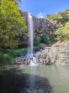
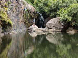
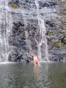
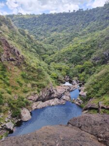
Customary snaps captured we found a safe place to cross the flowing water and started to make our way down the steep forest to the bottom of the 2nd cascade/waterfall. We zigzagged our way down, Rowin carefully guiding us as we dodged trees and stumps. Some of our other group’s members shoes probably weren’t appropriate as they tackled this section. As we came down we began to realise that we were going to be walking behind the waterfall. Whenever this happens it is an incredible experience. There were a couple of viewing points where we could grab a picture of the water falling from above. Rowin informed us that when we got to the bottom we could go for a swim. Already sweating in the heat this was music to my ears. We skirted our way around the edges to find our own little spot where we could gain access into the natural pool. I stripped off, climbed on top of the rock as I was told before jumping out into the pool. So cool and refreshing. I swam around the pool, before swimming underneath the falling water. I returned to the others and quickly dried off so we could carry on.

We left waterfall/cascade number 2. An impressive drop of water we hoped that the rest would be equally as impressive. For the moment we had done the serious descending, we went through some trees and navigated a muddy section before we arrived at the third waterfall. This one was tucked away on the other side from where we were hiking so wasn’t as impressive as the second one, we had just left behind. We quickly captured our custom photos.

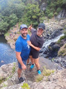
Sadly the 4th waterfall wasn’t that impressive either, on our approach there was a pool where a few people had stopped and whipped off their shoes for a natural fish pedicure (personally I couldn’t think of anything worse) but it did lead us to the top of 5th and final waterfall we would be visiting. Again, there was a ledge where the water was falling, now more confident we were able to grab a spot near the edge for a photo, Hannah more confident and daring now, Rowin as always, our willing photographer.

Photo’s duly taken we made our final descent around the edge of the water through the local foliage to arrive at the final destination. By now we were all ready to cool off. We quickly stripped off and a combination of sliding graciously in and bombing were witnessed. I managed to climb up a little bit of the waterfall for a full shower this time before bombing off. Nature’s gift provides much more fun than the latest smart phone or video game. After playing about in cool and fresh water, we climbed out, and, after navigating the uncomfortable ground back to our clothes, got ourselves ready to descend back to civilization.

Before we left the river, Rowin wanted to show us the top of the sixth cascade which I think was perhaps the most impressive. It certainly looked the highest of all the ones that we saw. Hannah, invigorated from her swim and hike through nature’s playground, was brave enough to join me to peer over the edge. It certainly looked a long way down and can see why it was a full day hike to complete all 7. Perhaps next time we can tick those final two off.


As the saying goes, what goes up must go down, or should I change it to what goes down must go up, sadly we had done the down first so we needed to get back up to starting point, where those sugar cane fields were. Rowin led the way and picked a gap in the trees which was an apparent path to the top. No struggling this time for us both, we were able to relax and enjoy this thoroughly compared to our experience on the mountain. Our only mistake was not re-applying the mossie spray, as they could clearly tell we weren’t local. We finally reached the top, after what seemed an age when we came out further into the sugar cane fields, we had earlier started in.

We walked slowly along a designated flat footpath back to where all the cars parked, and our taxi was waiting. It was here that we had to say goodbye to our guide, Rowin. He had been superb!! He provided us with two thrilling days of adventure, and certainly had taken us out of our comfort zones. Both days beat sleeping on a sun lounger. I’m sure we will keep in touch – he and his son are big Man Utd fans (yes I know that isn’t much fun these days). He is a fan of modern technology so this makes this cheap and easy to stay in touch. Common ground shared and a friendship built through travel is what travel is all about.

Join us as our next set of blogs as we look at some of the places we visited on taxi tours of the island.

Tamarin Trawling

Tales of our second trip will seem tame in comparison to those of our first adventure. Another early wake up was required for today’s activity (so much for relaxing). We were picked up at 0530 by taxi. It was the same driver that we had already met. We meandered our way a little further back up the west coast than we reached in yesterday’s trip to our next meeting point. You could feel the sun was rising, although we couldn’t see it yet. As each minute passed, the darkness that we experienced as we set off began to dissipate. There is something truly magical about watching or being awake for the sunrise. A glorious sunrise is spellbinding and often captivating It is certainly a great start to a new day and gives a chance to reflect and be grateful for another day. It provides inspiration to live for the day.

The sun was rising behind the mountains that covered the terrain on this part of the island. We arrived at the former fishing location of Tamarind Bay. The fishing economy having long gone, this was now a tourist hub for watersports. Laying peacefully in the bay were jet boats that would take tourists out onto the crystal-clear waters in sporting pursuit of mother nature. Our day was going to be by paddle power. We ignored the boats as we left our activity centre carrying our sea kayak. Tired though we were, we were both excited and invigorated by this new holiday hobby we had embraced. This day was a stark contrast to the first time I booked Hannah onto such an activity in California. We made our way to the water’s edge. We waited for another couple to join us and for our guide. The beach wasn’t as clean as the one at our hotel. There was more seaweed here. We put our toes in the sea to get used to its temperature whilst a couple of local dogs ran merrily around the beach chasing each other. Such energy for first thing in the morning and a reminder of what we had left behind in England.

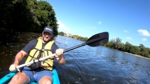
Our guide arrived, not with a kayak but a paddle board along with the other couple. We quickly established that they were French, and our poor guide was going to have to speak in both English and French as both couples weren’t strong enough in a second language. We had a quick lesson / recap on how to kayak and the importance of working together in unison, before pushing in the kayaks and jumping on. Someone had made a joke that kayaking can be the grounds of serious disagreements that tests the strength of a relationship!! This may have been true the first time we tried this out but this time we were quietly confident of our ability to have a good time. As we left the shoreline the sun was just peeping up over the mountains to say hello. The sun rose higher with each stroke, to keep us very warm.

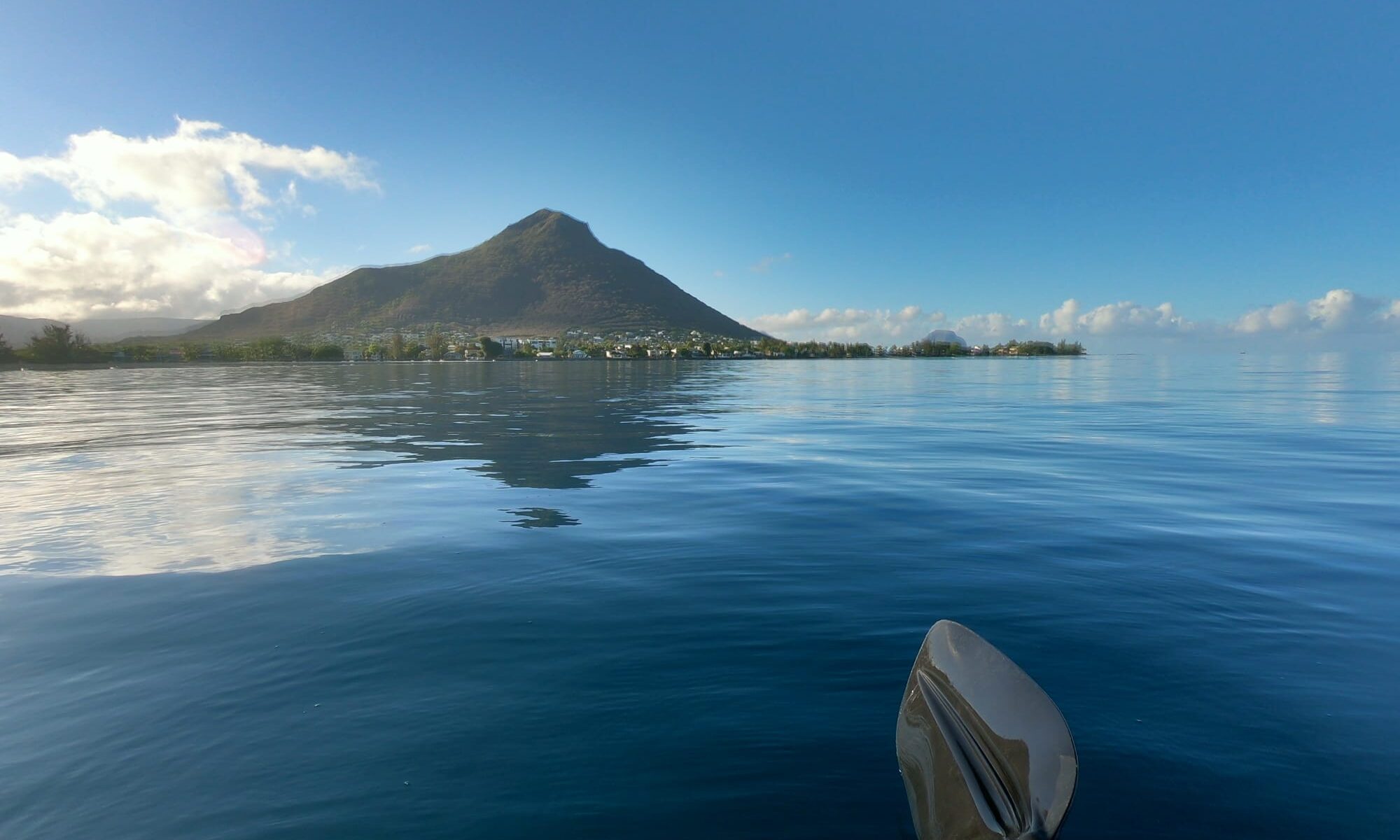
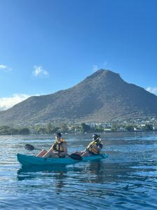
We paddled our way out to the entrance of the bay, on what must be said were very calm waters. To our left was the mountain (Le Morne Brabrant) that we had climbed the previous day and to our right was the start of one of the island’s famous coast lines called Flic en Flac. Behind us, I believe, were the mountains called Trois Mamelles (literal French translation – 3 udders) and Rempart (French for fortification).

The main reason for kayaking out here was that this was a renowned feeding ground for the local dolphins. They must have known that we were coming and decided that other local bays would be more appealing than showing us their playful nature. We waited patiently bobbing up and down on the ocean. We shared stories with our guide, who was also a big fan of Italy. Today wasn’t our day – the other bays must have been preferred – and our guide suggested instead that we return to the shore and picked up the river that flowed into the bay and kayak upstream. We all agreed and turned and headed for land. I must confess that I couldn’t see where we had started so we had to have full trust in our guide that we were paddling in the right direction. By now the sunshine was there but a stiff morning breeze was blowing the wrong way for us. We certainly had to power our way back to the shore.

Upon arrival, we climbed out of our crafts and dragged them through the very shallow mouth of the river. It was noticeable how quickly the water colour changed from the ocean blue to the brown and murky river. Once we cleared the shallow water we jumped back in the kayaks and made our way upstream of the Rivière du Rempart. This was one of two rivers that converged at the shoreline with the other being the Rivière Tamarin. It so happened that we were to explore more of this river on the next day on our third outing (watch out for the blog on this).

Back to our exploration of the river Rempart we noted that there were large houses belonging to wealthy people that were dotted on one side of the riverbank as we set off up stream. Every now and again a deafening noise of birds or local building works would disrupt the solitude. As we passed the final house our guide was quick to point out that this was one of the most important house on the island. It belonged to the head of the Christian church of Mauritius. A beautiful red roof rested on the arches surrounding the outer porch. There were well-maintained lawns. Through these arches a cross with Jesus on was clearly visible.

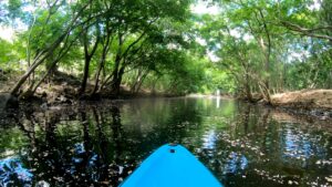
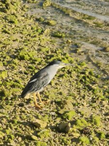
It was here that we left civilization and went more into an overgrown area. I was expecting Tarzan to swing in front of us as we ducked low level tree branches. We swerved around the low level rocks. Our guide informed us this was a place that he would come to escape, chill and relax. How true this is I will never know but it certainly wasn’t a place for us as we would have been eaten alive by the mossies. So, we thankfully turned the kayak around before we retraced our steps (sorry I mean strokes) back to the confluence of the two rivers with the sea. It was here that I was becoming fascinated with a local bird a ‘striated heron’, I believe. They were everywhere you looked.

Sadly, our time on the kayak had come to an end, which was good job as we were now both starting to feel rather hungry, and the mossies were certainly getting well fed on us. These early morning starts are great, but they mean missing breakfast at the hotel!! On a positive note, the early start means that one is back in time to spend the rest of the day lounging around, which isn’t a bad thing.

Watch out for our next adventure as we combine the water and the hiking.

Loving London

Not a war time cry across the wireless but a phrase from the lyrics put together by ‘The Clash’ and with which its song leads I feel ‘London Calling’. The Clash would follow up their leading line with ‘to the faraway towns’, and this is so as I sit on the train back from this incredible city and return to my faraway town.

Some would associate London calling with the punk record or look back at memories of when it was the leading line on the wireless before the BBC would deliver reports on the darkest periods of World War II. Relaxing by letting the train take the strain I start to ponder how on earth I can write a single blog about the ‘greatest city’ on earth, that has become the laughingstock around the world recently’ apparently. I will stay away from the politics, after all this blog is about travel, London has been calling me for a while now, but though my mission to visit every city has taken a hiatus, everything now looks to be getting back on track.

A city like many others on this personal journey, it is steeped in so much of Britain’s history, which is infused through every nook and cranny of this metropolis. It was the Romans who first established this city some 2000 years ago, before many ups and downs created what is seen today. The Black Plague, the Great Fire Spanish flu and even the German Luftwaffe tried to destroy it, but she still stood firm. These are just a few periods of its incredible history that have shaped the city seen today and perhaps are reasons for so many visitors.

London lures many people to visit, to work or even to in live in, I’m included in that number. What is the reason? Politicians strive for power, investors and bankers seek their fortune, some people arrive for a glimpse of the monarchy, or others just like to find fame in that ‘Instagrammable’) location. The facts surely speak for themselves. Before the pandemic struck, some 18 million people came to visit the city every year. This is further evidenced by London being voted the greatest city on the planet on numerous occasions. This, of course, is open for debate.

Someone wise once said, ‘Why, sir, you find no man, at all intellectual, who is willing to leave London. No, Sir, when a man is tired of London, he is tired of life; for there is in London all that life can afford.’ Sadly, as I write this, I tend to disagree because, on this day, I am willing to leave London. Has the world changed greatly from the day that this was said? In my opinion it has greatly! In my eyes the hustle and bustle are okay for a day or two, but full time? Not for me! That’s a rat race I don’t want to win. Perhaps many Londoners shared the same view as they flocked away from the city during the pandemic. As I see it there is a call from afar of green and pleasant lands that offer a quality of life that the city can’t match. Full time bloggers dedicate their blogs to this city. I’m just an inquisitive individual trying to learn about these lands.

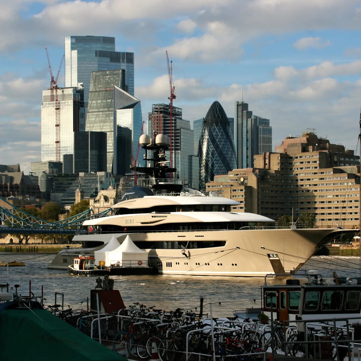
It’s that thirst for knowledge that has taught me London is two cities the City of Westminster and the City of London. The City of London is surely a far cry from the small fort the Romans would have established when they invaded these lands. When the Roman Empire fell and the Romans left these shores, the city has evolved from sticks and stones into the financial hub of the world (would need confirmation that this is still the case). Now referred to as ‘the square mile’. It is adjoined on the western boundary by London’s second city, the ‘bubble’ (sorry City) of Westminster (the chaos of that City is reflected in the daily news, and I will leave that for you to follow). These two Cities combine to form the central heartbeat (downtown – if you’re reading from across the pond) of what many people associate as being London.  The gothic grandeur sprinkled throughout as modern & medieval architecture stand side by side complimenting each other is a sight to behold. London’s addictive atmosphere evokes curiosity & excitement. This is true for me as a visitor, but for those who live here 24/7 they may have other feelings. These two cities, together with 31 boroughs, combine to form the Greater London Area (GLA). Camden, Hammersmith & Fulham, Richmond, Southwark, Greenwich to name a few. Six of these boroughs do not have “London Borough” in their names: the City of London and the City of Westminster, and the Royal Boroughs of Kingston upon Thames, Kensington, Chelsea, and Greenwich. For someone living in the countryside its astonishing to think that an incredible 9 million people call London home which is more people than live in Wales and Scotland combined or the entire population of Austria. This amount of people surely gives the city its rich & diverse culture. Over a third of this 9 million were born abroad which means London is probably as international as it is British.

These cultures combine to give a mix of cuisines like no other city. Forget ‘the best of British’, as food lovers are spoilt for choice. When visiting or living in London people are spoilt for choices. There are a remarkable 87 Michelin star restaurants in the city and 3 at the highest 3* level. There are even rumours that there are more Indian restaurants in London than in Mumbai and that the food is better than can be found in that city. A quick troll through Instagram will show you some of the famous ones, normally accompanied by a rooftop view for drinks – they certainly are the craze these days. If food isn’t what you seek, then perhaps a pint maybe calling you. Pubs are part of the very fabric of Britain, and it is claimed that in London you are never no more than 7metres from one (again how true this is I shall let you decide). The capital boasts some 7,000 public houses and inns. Afternoon tea is another very British tradition, and London (where it originates from?) does it like no other. A visit to the Ritz, Claridge’s, Browns, Dorchester and The Berkeley are all worth the financial outlay.

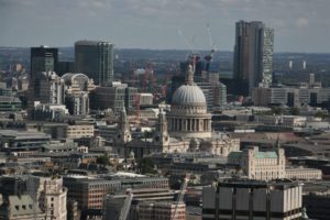
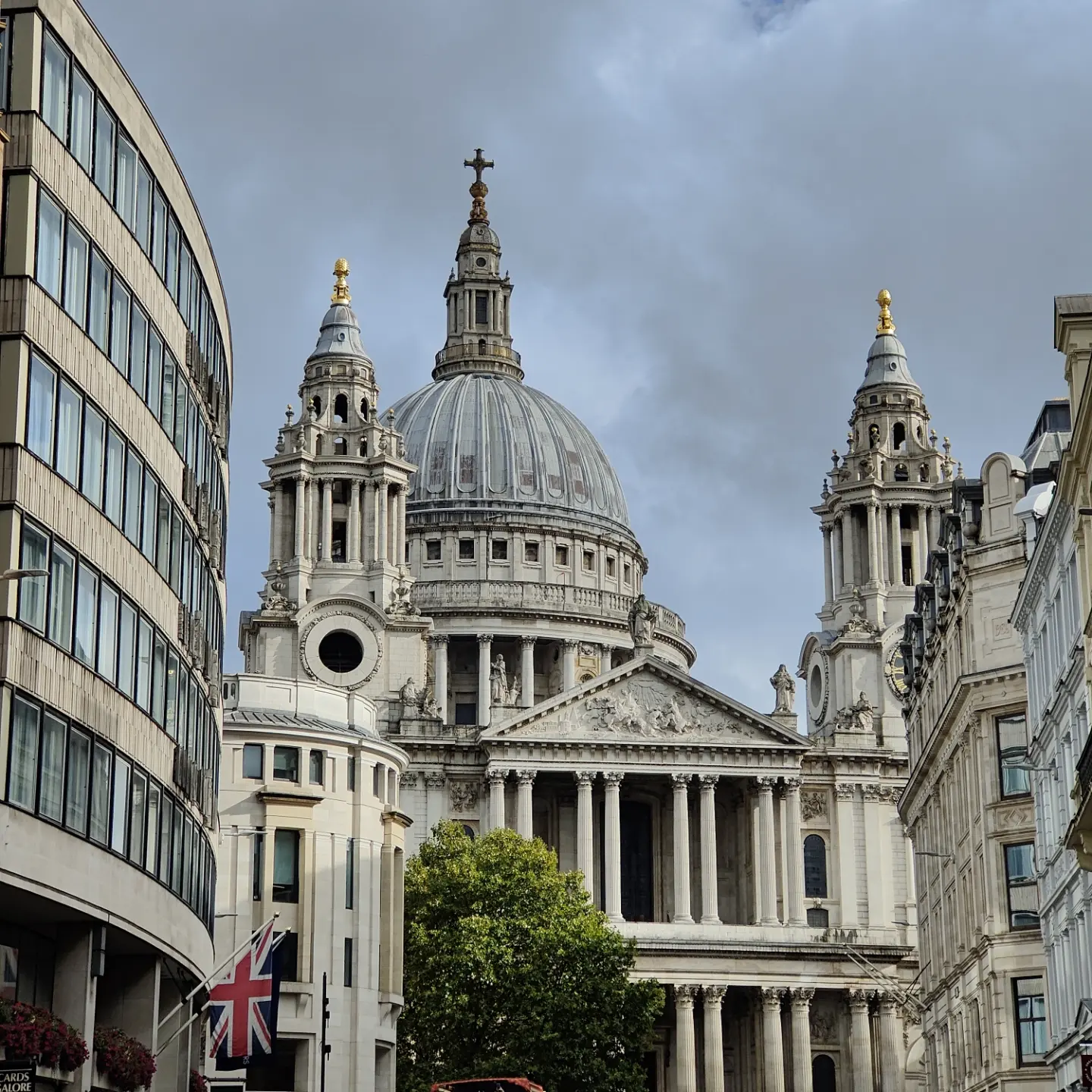
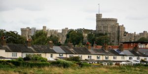
But London is more than food & drink. It can boast an incredible 4 separate world heritage sites. It has 2000 years of history. Meaning it has something for everyone. The Romans established it, it survived the dark ages before evolving through the Middle Ages, and now as technology advances at a rate of knots who knows what she might become. The great British Isles are blessed with many castles, London incredibly only boasts one these days, The famous and much visited tower of London. At one time there were 9 castles surrounding the city, but the only one remaining is to the west, which is her late majesty’s resting place, Windsor. A town not so far away, only a day’s march back in the day is well worth a visit but shouldn’t distract you from the time that would be lost to the vast amount of museums London has to boast. You could spend a couple of weeks in London and still not visit all the museums, as there are over 170 of them. The best thing is that most of them are free! Half of the 2 millennia (of the Christian era) have been ruled by the monarchy. Westminster Abbey (along with the Tower of London) dates back to the Norman invasion. Westminster Abbey is where our kings and queens are crowned. There is a fascination with the monarchy from old to young and far and wide, and while it gives us our rich traditions, values and pomp and circumstance the whispers grow louder for its very existence. London’s more recent history has been absorbed in political infighting that has come off the back of pandemic management. As we leave the ‘pandemic’ London, like the rest of the Europe, survived as it did the great Plague and fire. During the great plague some 40,000 Londoners were wiped out in 1665 and a year later the great fire tore through the city, but she still survived. As the city evolved from the turmoil of an epidemic and then ash, it rose again. The present St Paul’s Cathedral is testament to this. It left the medieval ages and golden years and went on to become the modern masterpiece everyone seems to love now. The impression I have is that much of London’s success can be put down to the Victorians. There may be similarities with the here and now as Britain looks to carve its new place in the world post Brexit. Perhaps some inspiration can be gleaned from its great and long-standing history. London is also home to some quirky street names.

I mentioned ‘wannabe‘ social media stars flocking to the city for the perfect location for food or spending money in the city’s fashionable drinking and eating establishments. Their arrival is clearly the city’s business gains. London is also one of the 4 fashion capitals of the world and is home to more shops than Paris. Oxford, Regent & Bond Street are famous as are Harrods in Knightsbridge, Saville Row or, my personal favourite, Covent Garden.  Fashion is so popular in London that it requires two weeks and not one in the calendar year for its fashion week. The city has also produced some famous names in the fashion world – Naomi Campbell and Kate Moss to name a couple.

With many people living, working or visiting the city, it needs a transport system like no other. Green taxes and overcrowded roads mean driving in London isn’t for the faint hearted. London is served by the largest city airport network in the world. The 6 airports that form this service to the city are Stansted, Luton, Southend, City, Gatwick and Heathrow. The London Underground with its famous map is an experience not to be missed when in the city. It’s the oldest metro system in the world, 402km long and boasts an incredible 270 stops. It is reported that 1.3 billon single trips are made each year on the ‘Tube’. It is also an interesting fact that more of the underground exists above ground. How could one write about transport and not mention London’s iconic Black cabs and red buses. They used to dominate the roads of the city, but now they are competing with uber, and bicycles as alternative forms of getting round. As the world looks to green alternatives, possibly the best way to explore the city is by foot. It’s certainly my favourite way to explore the place. You’ll hopefully be able to read my blogs soon of when I completed the Thames path which took me right through the heart of the city. The City is classified as a national forest. There are an estimated 8 and half million trees in the city with over 300 gardens. This equates to 40% of London being parkland.

So, as I draw this slightly longer blog to a close, I can only apologise for its length. Hopefully you can see how difficult I have found to condense this blog about the city, and I’ve barely scratched the surface. So, as I look to explore this great city in further detail, the capital of capitals, watch out for more and more blogs on this fascinating city. I will return to that famous quote ‘when a man is tired of London, he is tired of life; for there is in London all that life can afford.’ I’m not tired and look forward to returning. Are you tired of London? Answers on a postcard (email) please….


Eton Style

I love the Boatman for there I can eat in style. It is great to sit by the river in the grounds of the same pub mentioned in the piece on Windsor. I was in good company this time and the sun was shining. Lunch had been demolished and I toyed with the idea of indulging in some broken pavlova, mixed in with strawberries and lashings of cream. Instead I decided to cross over Windsor bridge and explore the town of Eton rather than indulge in its namesake dessert. My waistline almost expressed its gratitude for non-indulgence as I set about seeing if there was a link between the town and the dessert. It is rumoured that the dessert was to be served at some time during a cricket match between Eton and Harrow, it was dropped (hence the mess), and scooped up and served as it was.

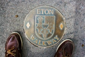
I crossed the famous bridge, like so many have done before me. I expect that many visitors to Windsor have not gone on to explore the other side of river and the famous town but rather stay on the bridge and capture an image of the castle from there. Instead I left Windsor behind and started to make my way up the high street which is possibly like no other in the land but, sadly, on this day resembled more of a building site than a bespoke arcade. The ubiquitous British flags and bunting still adorned the street, providing much colour above as cars littered the street below. Whilst walking along the pavement I was drawn to some lonely books for sale outside a bookshop. I picked up one that said, “considered to be Dickens’ finest novel”. What a great purchase this may prove to be, as I look to create my own library and find a love of reading. Oh, where was this appetite when I was young? I went to purchase the book and grabbed a booklet regarding the “Eton walkway”. To my delight I was informed by the quaint man behind the desk that it was free. I was delighted that purchasing a book had resulted in the acquisition of a free guide to my afternoon of meanderings. So, I left with one of England’s finest works and a guide to show me the best bits of this town.

As I wandered up the high street, I was able to identify the points of interest as my step by step guide explained them all to me. A red pillar box, for example, once a common feature on the streets of our nation, only this one is a rare one indeed. Only 10 of these types of box exist in the country, and as a result it is grade II listed. A vertical slot for posting letters was puzzling to see. The guide took me further up the high street passing the Porny School towards Baldwin’s bridge. Just before the bridge are a couple of colourful shops that, on closer inspection, proved to be tailors. How does such a small town justify two tailors? Well this high street probably relies heavily on its ‘town and gown’ tag for just over Baldwin’s bridge lies Eton College.

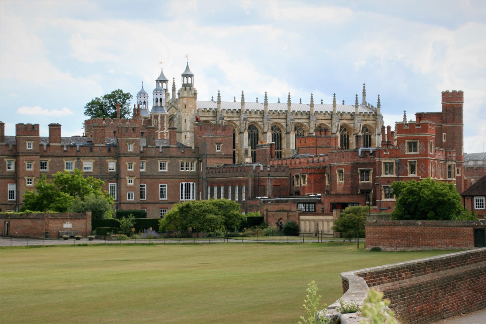
The famous college was founded in 1440 by Henry VI and is dedicated to the Virgin Mary. As one approaches the college from the high street the first part one sees is the chapel. Not looking like a chapel, one can only assume what it’s like on the inside. The windows in the chapel were destroyed in 1940 during the bombing raids on England. On the outer edge of the chapel and, unlike much of the college, able to be seen by all is a plaque regarding William de Waynflete, a former bishop of Winchester, who paid for the completion of the chapel.


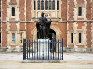
From here one approaches the main gates to the school.  It costs around £14,000 per term for education at the college. Originally 70 scholars were educated for free and provided with accommodation. Whether this is still the case in these financial times I’m not sure – I doubt it. Access to the school is very limited but a sneaky look through the grand gates will allow one to see the statue to the founding king in the centre of the quadrangle.

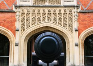
The college dominates much of the town, with 24 houses providing accommodation for over 1300 pupils. The mind begins to boggle at the finances this school operates with – oh how different to the budgets in state schools. On the other side of the road lies the second main quadrant of buildings for the school. Immediately you are drawn to what lies in front of the centre archway. What school do you know that has a historic cannon on display? A completely different world. It does provide wonderful photo opportunities as the marvellous stonework behind the cannon adds to the image.

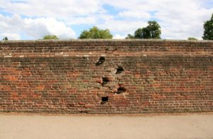
The walkway then started to bring me out of the town. It was here that perhaps the finest view of the college was captured. As I stood there and took the picture I wondered if I was actually taking a picture of a college in Cambridge. Is there a link between the two establishments? It was also at this point I had passed some surprising iron rungs in the wall with my guidebook informing me that these are there to provide pupils access to the top of the wall to watch the ‘The Wall Game’. This takes place in the autumn term and is perhaps unique to this college.

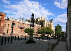
The next part of the walkway involved me getting a little lost as I tried to pick up access to more of the buildings across the college’s greens. I eventually found my way back onto Common Lane which brought me back to the main college buildings and the top of the high street. It was here that I found ‘the burning bush’. Designed to help the boys cross the road safely, it was moved from its original location when the cannon was put in place. Now a significant landmark of the town and photographic opportunity, it also takes its place in front of a doomed building which bears similarities to that of Radcliffe Camera in Oxford.

Pressed for time, I return towards the river, passing some other points of interest which include the natural history museum and the museum of antiquities before coming across the church of St John. The church is now a shadow of former glories and has had to find a new way of surviving, the school coming to the rescue and converting it into accommodation and a local doctor’s surgery. Oh, how the religious landscape of this nation has changed.

My return to the river beneath Windsor castle completed the ‘Eton Walkway’. It had been an incredibly informative and pleasantly surprising walk. I left with another book for ‘my library’ and many happy memories. Anyone who visits Windsor must plan a longer trip than those arranged from London as they only give the visitor a couple of hours here. Windsor and Eton are worthy of more than a casual glance. Stay a night and spend some serious time here and you never know what you might find for across the river lies the town of Eton, dominated by a famous school and the town is associated with a dessert we all surely love. Why wouldn’t you want to explore Eton?

Eton, England, United Kingdom

Busted Bradford

The first sight of Bradford was of a lonely chimney billowing out white clouds into the atmosphere. Evidently smoke was pumped from the many chimneys that once “adorned” this market and industrial town. The single chimney was a poignant reminder of the past and of the changes that this city has undergone. My expectations for this city were very low. It wasn’t one of those cathedral cities that are so rich in history and beauty. It was a town for many years before that wealth of 100 years ago brought about expansion. Nowadays Bradford is associated with its diverse cultural population and industrial heritage.

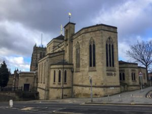
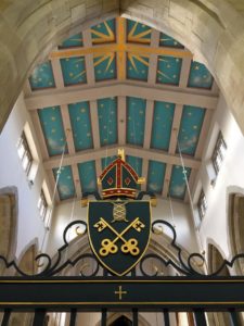
My arrival into the city did not endear me to the place – lorries, dodgy ring road (how do you know where the cars are coming from on these things?) An industrial heartland clearly devoid of any real beauty. Rumour has it that if you were to leave Bradford you would find some beauty on the Ilkley Moor or in Bronte Country. The drive in was atrocious as lorries vied to control the roads. Somehow, I managed to follow signs for the cathedral and escaped the mayhem of the dual carriage ways. I dumped the car which was relatively easily in the city centre in affordable car parking. A positive. The city is perhaps one of the country’s youngest. Up until 1733 it was merely a sleepy market town surrounded by trees. Oh, how those days are long gone! My first point of interest was the cathedral. One of England’s newest and smallest perhaps? It certainly wasn’t part of the blueprint that Henry VIII created all those centuries ago. In fact, this church didn’t become a cathedral until 1919 as a new diocese was created separate from that of Ripon, which in turn had been created due to the vast size of York’s diocese. There is no mention of Leeds here, so I wait with anticipation to see what that city delivers as Bradford clearly is more than a close neighbour. It is almost like two cities merged together.

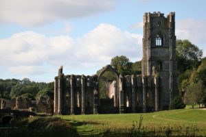
As mentioned, the cathedral is more like a large church. It is no way like the glamourous cathedrals that this country boasts. From the outside impressions this was not going to be one that would become a favourite of mine. Perhaps its beauty was to be found on the inside. I stepped inside with intrigue and was immediately impressed to see the welcoming sign declaring no entrance fee! Well done. My visit inside interrupted some form of gathering, so I rather silently and fleetingly made my way round the edges. The inside is not the work of art that others boast; this was clean and pristine and almost new. It still had some fascinating stained-glass windows. One in particular was of interest as at the bottom it looked like Fountains Abbey(?). My whistle stop tour was brief unlike other cathedral visits; this one had no real appeal. The outside on one side looked like it had experienced TLC, the other side a polar opposite. Weeds and overgrown grass covered an unloved graveyard.

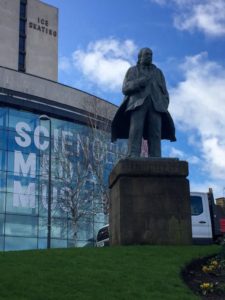
I left the cathedral in search of what might be the city’s charms. Would I find any, who knew? Its reputation didn’t promise many. But, isn’t that the fun of travelling and exploring? I immediately came across the main shopping complex, a modern monstrosity which somehow seemed like a clinically clean establishment in an otherwise dirty environment. I was immediately drawn to ‘to let’ signs in a window. Was this a sign of things to come or the ever-increasing confirmation that our high street is dying. You could say that the internet is the cancer that is destroying town life. Every now and then councils and governments give these towns a fresh hope of new life after a makeover, but slowly and surely their chances of survival decreases by the day. To get to the city centre I came around the Kala Sangam, an art centre. Lying in between the new mall and Kala Sangam a statue to the WE Forster (who he is – I don’t know; a search on the internet shows that he was an industrialist, philanthropist and generally good guy). In passing I read about another good guy (still with us) from further up country who is trying to revitalise a town, the name of which escapes me. In an interview he described the word philanthropist as a ‘vomit-inducing’ word. Very interesting coming from one who wishes to plough some of his wealth back into society. Back to Bradford. In glorious sunshine this statue gave a positive feel to the centre. A quick walk through the modern hustle and bustle and I was off to find the city park and town hall. It was here that you can begin to see where Bradford’s reputation lies. Buildings not in use, lost souls wandering the streets aimlessly, a prolific police presence. Now I was beginning to see where the city’s tarnished reputation came from. I felt like a foreigner as two distinct cultures are evident. I was amazed to pass a cycle shop that displayed a sign claiming that this was the city of cycling. A thousand bikes in Amsterdam or Beijing it was not. I can’t recall seeing anyone pedalling.

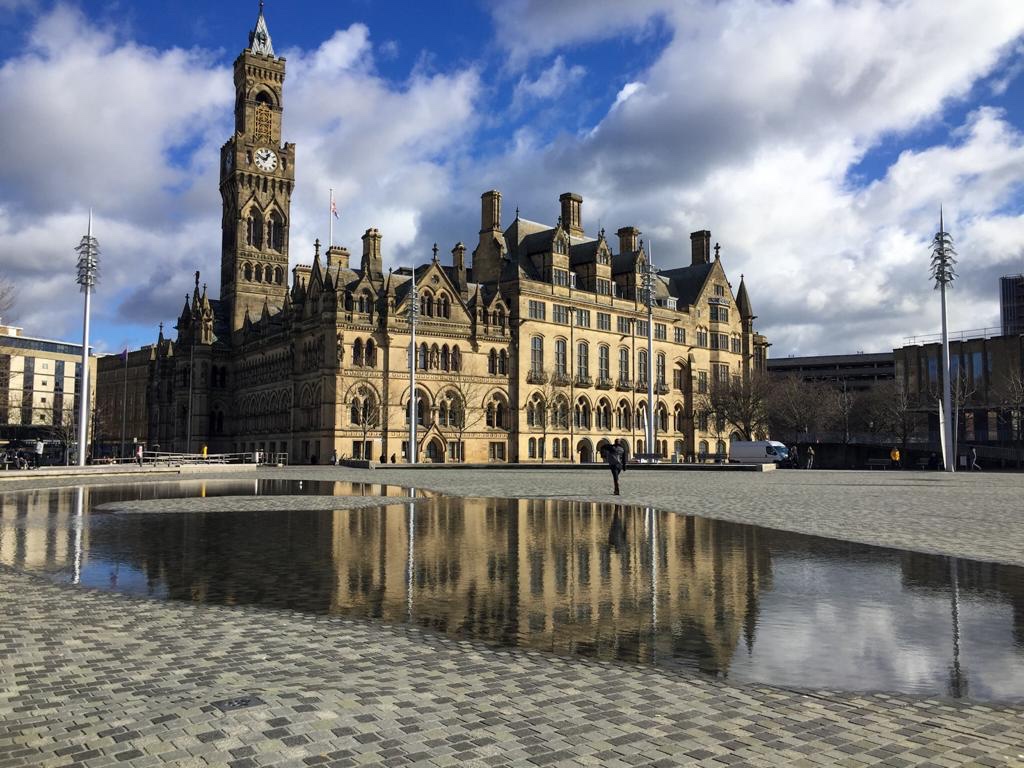
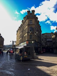
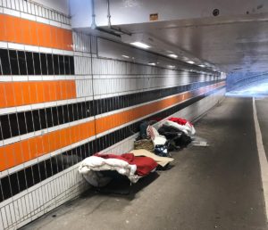
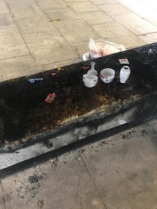
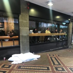
I won’t say this was my most treasured or favourite city walks, there was a fear that accompanied my every step. There was no clear heart and soul of the city. Instead a trail of mess, abandoned stores, homeless people and carefree individuals strolling about the place. Also throw in an evident mixture of cultures and it made for a diverse spectacle. I walked round, passed Bradford’s idea of the flatiron building from New York and made my way to the town hall which was something that you would associate with our friends across the pond than a city in England. This is clearly a focal point of the city centre. Next to it lies the modern enhancement of a Mirror pool. On arrival I thought it was a puddle left by the heavy rain, but it was put there on purpose. When the wind died down it did provide puddlegram opportunities of the highest order. A park in the city centre naturally attracts all that’s good and bad with a city, people happily mingle on lunch breaks on one side as rowdy and noisy kids boom out their modern rap music for all to hear. A pleasant and yet equally forgettable experience.

From here I made my way to the theatre Alhambra. Its appearance is more in line with that of a mosque than a west end theatre. It was perhaps surprising to see my favourite west end shows advertised on the outside – ‘The Lion King’. Directly next to it is the science and media museum. If more time was available this should be visited as it’s free to enter and has links to the city’s history of film and photography. Lying in between the two (the museum & the theatre) are the war memorials and a Victoria statue.

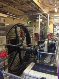
Bradford became wealthy in Victorian times. Perhaps they thought she was recognisable. The wool mills that made it a virtual capital of the world clearly brought wealth and prosperity. Sadly, this wealth looks a thing of the past. A visit to the industrial museum shows the power that once was associated with this place. Old machinery is now a thing of heritage keepsake as more modern advancements mean these machines are redundant. A visit to the museum shows the size of these enormous, “satanic mills” that were surely a death trap to most but, the sale of the products they made lined the pockets of a few. There are many information signs confirming the perils and dangers of working in such an environment. Children were sold to the mills in order to grow personal income. How times have changed! Health and safety, slavery, equality and working rights personnel, had they existed, would have had a field day. There were other exhibitions in the museum that provided insight to Bradford’s association with cars. It was a pleasurable to admire the quality of craftsmanship. My short visit gave me enough of an insight into the tough and hard upbringings that the people of the city must have endured.

So, my voyage into the unknown has provided me with much food for thought. With expectations low, a reputation it clearly needs to shake up, the city provided many a good photo, but that shouldn’t muddle the mind. For this is a place that shouldn’t be visited alone and with your senses focussed. It has given me some sight into the industrial revolution some 200yrs ago, but as we now encounter a technological & social revolution, the similarities with a past industrial revolution might soon be there for all to see with the demise of the high street.

Bradford, England, United Kingdom

Lexicography in Lichfield

It was on a cold and wet winter’s day that I discovered Lexicography in Lichfield. By the time I had left I felt a warm affection for Lichfield. I still can’t believe that I have found another cathedral city. I thought I had visited most of them already, but this is another one to add to that list.


The term ‘city’ is a word we associate with large metropolitan monstrosities like Birmingham or Southampton, but England’s unique history allows for some truly interesting places to be called a city. How can a city with 10% of the required population for modern towns applying for city status be called a city?? A quick tour of Lichfield is just that. It is obvious to realise that it’s not very big but for a couple of centuries it had something its more illustrious neighbour didn’t have. When Henry VIII redrew the religious map, Lichfield was one of six towns which was given city status based on it having a cathedral. It now sits in the shadows of England’s second city Birmingham; whose growth and wealth meant its population of well in excess of 300,000 would ensure it was given city status. By the way, this rule was brought in by King Edward VII. Now hidden by its noisy neighbour it further illustrates the decline in religious power conceding it to that of commercial and population factors. Surely it is for this reason that the very existence of this charming place is known by only few people. I certainly knew nothing of it until I discovered it on a work trip and as part of my mission to visit every city in England.

The city itself has some interesting history associated with it. Once a prominent pilgrimage site, it was laid to siege three times during the civil war and is the birthplace of Dr Samuel Johnson. More on the cathedral and the good doctor later, but Dr Johnson claimed that Lichfield was a city of philosophers!!

Lichfield was founded around 600AD. There is some evidence to suggest that this was a trading post for the Romans on their way from London to Chester. Evidence is scarce for this hypothesis. St Chad later in the same century set up his bishop’s seat here. This led to it becoming a focal point of Christianity in the Kingdom of Mercia. Mercia was one of 7 Anglo-Saxon kingdoms in the country and along with Wessex and Northumberland was considered to be in the top three. It is argued that its capital, Tamworth, was the capital of the whole of England at a time. As a result of its high profile the town of Lichfield becoming a pilgrimage site as the remains of St Chad were buried here.

When the Norman’s took over the rule of this country, they commissioned a Norman cathedral to be built at the site. This cathedral would evolve over the years and would appear to have been a fortification as much as a place of worship! It took over 150 years to build and is apparently one of England’s smallest. This is always hard to gauge when you visit these places. The vast size of them is awe inspiring and one dares to think about how on earth they were ever built. Walking around the cathedral you notice that the spire looks hollow. Perhaps it fell down and an alternative was put in its place. The front façade is captivating. There are 113 figurines that have been carved in stone. The people represented are a mixture of kings of the lands to bishops most of whom I had never heard. A visit inside this huge space makes you feel very small in such a vacuum. Henry VIII of course had to have his say – he removed the shrine to St Chad. Some of the relics destined for destruction at that time were preserved and can be found in nearby St Chad’s in Birmingham. Upon leaving the cathedral and directly opposite it is ‘the close’ which is a collection of old cottages. The cathedral is on a slight hill and it was no doubt built here as the higher ground was chosen to build a stronghold to wave off attacks. The town was loyal to the king during the civil war. The town had been a staging post since Roman times, so was of importance for conveyance of troops and supplies. The hardships of the war were evident. By now Lichfield had become a city and one that was fought over and bruised. The cathedral itself was no different. Throughout its long history it has changed hands more than once. Lichfield’s troubles during the Civil War were exacerbated by the fact that the people were loyal to parliament and the authorities loyal to the king. A visit to the cathedral is fascinating as tales are shared with rumours of shots being fired from the spire and evidence of damage to the spire by way of shots fired in retaliation.


I finally managed to drag myself away and make my way into the small city centre. At its heart is the guildhall which is now a library.

It was next door to the guildhall that I discovered a fascinating museum. The rain was pouring down now and heavier than previously making a tour of unpleasant. I was looking for some respite and the mention of free entry on the sign enticed me in. Lichfield is the birthplace of Dr Samuel Johnson. To my shame, I knew nothing of this man. The grade 1 listed building was a trader’s townhouse but is now a museum dedicated to the great man. In 1777 he had this to say, “Why, Sir, you find no man, at all intellectual, who is willing to leave London. No, Sir, when a man is tired of London, he is tired of life; for there is in London all that life can afford.”

A pleasant man provided an enthusiastic welcome and I was in!! An informative video along with many information display boards meant for an educational visit as I learnt what a lexicographer is. Lexicography is the compiling of dictionaries.

The doctor was the son of an impoverished bookseller before he made his way to London to make his fame and fortune. Before he made that trip to London, he took on the role of a teacher. One of his pupils, David Garrick, was to go on and become one of the leading actors of that time. The theatre in the town is named after him I believe. The doctor made many other memorable sayings. There was one in particular that stood out and was quoted on the wall, “You can never be wise unless you love reading”. I will admit to never have loved either reading or wanting to be wise, but, in a depressing modern world, inspiration has to be taken from these philosophical words. I must make another visit sometime for further inspiration.

So as my time in Lichfield draws to a close and further travels have to be made, I leave with this thought taken from a conversation the doctor had with James Boswell (he wrote his biography – it is said to be greatest in the land and surely something to add to my reading list), “I lately took my friend Boswell and showed him genuine civilised life in an English provincial town. I turned him loose at Lichfield.” What a sensible and profitable thing to do.

Lichfield, England, United Kingdom

Excellent Exeter

My meanderings take me to another of these small and charming English cities, excellent Exeter. This city oozes much charm and packs a lot of character into its relatively small city centre which is enclosed by a wall. Comparisons could easily be made with other cities that have recently been visited in these shores – their similarities are startling. It’s surprising, that in my mission to visit every city in England, I haven’t been here sooner. About an hour’s drive from my current home, it is the birthplace of my mother and as a result was a regular destination for my school holidays.

Surrounded by beautiful Devonshire countryside, the city’s location has been founded and forged over the centuries close to the river Exe. Unlike other cities the river doesn’t run through its heart, but the river has still played a key part in the city’s rise and fall. Perhaps the city centre is on raised land that overlooks this river and would therefore provide a strategic position. A walk down to the quayside would confirm its elevation above the river. The river and quayside like most other places in England would provide much of the wealth and regeneration of the city over the centuries before the railways came.

Exeter’s wealth was built around tin in the 11th century and wool in the 18th century. Exports at this time relied heavily on waterways and ports. Exeter is a good way from the English Channel so use of the estuary (at Topsham) and eventually manmade canals gave it two thriving ports. The first port used in Exeter wasn’t the quayside that I had discovered in the city centre but at Topsham on the outskirts. If more time was available perhaps a walk from the city to Topsham along the river might be advised, to explore and learn about this key part of the city’s history. When the Romans arrived at Exeter, they used Topsham as the port, although the river was navigable into the city centre. Over time, arguments ensued, greedy people who owned the port did strange things (weirs, mills and the like), ownership traded hands, which eventually led to a canal being built in the 15th century. This was expanded and developed in the 16th century as trade with Europe had grown. Due to the canal bypassing Topsham its port was ignored, and boats now embarked at the quayside near the city centre. This resulted in the first brick building in Exeter, the customs house. What was once a place for weighing and paperwork of imports and exports, it is now home to a museum/activity centre documenting this part of the city’s unique history. Sadly, time or access didn’t allow me to visit it. The rest of the quayside represents nothing of a port these days, canoes and kayaks the only noticeable boats in the harbour but it has undergone regeneration as quirky shops, eateries and drinking establishments adorn the industrious quayside to amuse this modern generation.

The quayside was a fascinating discovery to make about the city. I’d imagine I had been as a kid but it’s an area that I have rather disappointingly overlooked in recent times. As you leave the quayside you have to walk upwards towards the city. This confirms the raised hill that would have overlooked the river. It is here that you get your first glimpses of the city walls. The charm of the city is encapsulated like other favourite cities by these protective city walls. Exeter’s walls certainly aren’t as glamourous or accessible as others seen. They certainly seem a thing of nostalgia and neglect. The best views of the walls can be found situated in between Northernhay and Rougemont gardens. I rather stumbled across this tranquil set of gardens as I tried to get off the bustling high street. It was here that I discovered Exeter’s castle. Not much to report as I firstly found signs and information relating to history of the Castle and the former gatehouse. Access beyond this wasn’t easily found and not much sign of a keep. The parks are a combination of the former city walls, flowers and several statues. I would imagine on a nice summer’s day a perfect spot for relaxation and views of the city. Sadly, on my rainy autumnal day the views were washed away and I had the place pretty much to myself, each and every cloud.

Exeter was thriving in the 11th century, tin trade brought wealth and prosperity. In turn there was a  church established. This led to Exeter boasting as many as 30 churches in the city centre. Clearly not all remain as England’s turbulent history would impact on their legacy. I have discovered that as a result of this one of the streets in the city housed religious people and was referred to as ‘street of priests’. At the heart of the city lies its impressive cathedral. England is perhaps blessed with so much history. These cathedrals are a great demonstration of England’s turbulent and interesting past. The cathedral is surrounded by a close, entrances and walls. There is much to learn and discover about the cathedral and this particular area. It involves plots, executions and a royal visit to sort the mess out. As a result of that 12th century drama the building of a wall was commissioned by the King around the cathedral which had some 7 gates to provide access not only to the cathedral but the building yard that had caused the drama. A step inside the cathedral will lead to the discovery of a disappointing £7.50 entrance fee. The damp and wet weather outside meant that exploring this cathedral was a must, so payment was made to avoid traipsing around in the wet. Once the customary photos had been captured and the whole place had been explored it was time to get back outside. There is a green that surrounds one side of the cathedral which on sunnier days surely would be much more appealing. Along one side of the green is a row of houses that lead from one of the mentioned gates and merge into a warren of other buildings now housed in the city centre. A fire ravaged a hotel here recently (the oldest hotel in England?); building work has begun as it tries to return to former glories.


Exploring this intertwined maze of buildings is an absolute pleasure. Modern buildings hide the old ones. It is difficult to view these now as Exeter’s appeal for shoppers has enticed everyone in and people walk past carrying loads of bags. The new modern shopping complex is built a stone’s throw away from the cathedral yet has still managed to keep the ruins as part of its meandering landscape. Exploring here leads to many points of interest – alleyways, ruins, etc. – and my inquisitive nature leads me to explore some old churches and pubs. St. Martins church was a particular favourite and rumours are one of the oldest in the city. Its close proximity to the cathedral I found rather puzzling. The city has undergone some serious renovation in my short life time that I can visualise and remember. It is regarded as a excellent place to shop, wine and dine. How many of those enjoying those leisurely activities are blissfully unaware of the intriguing history and beauty in the city.

So excellent Exeter, a regular childhood destination, and place of former work has been added to my ever growing list of favourite English cities. I look forward to returning and exploring it again and again.

Exeter, England, United Kingdom

Ripon Rising

Here I was leaving Ripon after a pleasant evening spent there after work and blissfully unaware that I was leaving an English city until I walked pass a sign that said, “cathedral city of the Yorkshire dales”. On this mission to write a blog about every city in England I really should do some study and form a definitive list in order to start planning rather than just stumbling across these places. As I walked around, I genuinely thought I was in a small town that boasted a cathedral but had not got city status. My mind was a muddle as I tried to think about what gives a city its status and ultimately forgot that this might just be one. In an attempt to enjoy my evening, I wasn’t going to turn to my phone to give me the answer, although I did ultimately.

This small and charming cathedral city has left me a little dumbfounded. So small in size and in the middle of nowhere – how did it come about? Was it created as part of a religious area? How comes a large cathedral was placed here? There are no initial and clear signs of industrial links, albeit that as I left there, I could see a canal and railway. Could its existence be traced back through farming and markets? How blind to some things I had been as my eyes were focused on a safe arrival into the city much earlier. I have so many questions as to its creation.

Upon leaving my car, the first stop was the cathedral. It seemed small compared to some, simplistic even, with nothing grand about its appearance apart from the autumn sunshine gently warming its outer shell. This is written not to take away from Rippon’s cathedral but there are certainly more attractive cathedrals in these lands. I took those dreaded steps towards the doors to see if I was going to be charged to enter. Donations only!! Well done, but once inside one is immediately drawn to the way by which these places now have to find a way of surviving – in Ripon’s case it was an art gallery on either side of the main aisles. Diversification.

Some time was spent around the cathedral capturing pictures and finally I was led to the crypt. Although I went around it backwards (entrance not that clear) I wasn’t that interested in what I saw. Upon completing some research later, I discovered that this was in fact a 7th century crypt!! Its small size meant pictures were not achievable, hence my lack of interest. Not one to fuss, I didn’t return to take a picture upon hearing rumours that this is the oldest in the land.

As these autumn evenings start to draw in, time was pressing and as this was a work trip in what I thought was a town, I marched on in search of dinner rather than fully exploring this charming Yorkshire delight. In my search of dinner, I came across the Market Square. Almost completely surrounded by buildings, there are modern roads that now enlarge the breaks in the complete market square vista. A tall and commanding pillar/statue guards the square around it. The city still to this day is full of tradition as at 9 o’clock town’s horn blower blows his horn to the four corners of the square. This tradition (the world’s longest-running unbroken daily ceremony) spans some 1100 years as is referred to as “setting the watch”. As I walk around, I notice a sign that states about rebels gathering in the square in November 1569, after capturing Barnard Castle. By January 1570 hundreds of these rebels had been hung in the square for their rebellion against Henry VIII’s dissolution.

Close to the city lies Fountains Abbey, something that must surely be explored upon returning to this area. This is a fine example of the footprint/legacy that Henry VIII left on this country. The ruins that remain still show the sheer size that abbeys/monasteries once were and, consequently, the power they once had. I would imagine that if they could be lined up against each other that Fountains Abbey would dwarf Ripon’s cathedral. It adds a layer of intrigue and one that must be explored upon returning. Was the cathedral created after the destruction of the abbey or do their histories coincide? Clearly there are signs of a church being at the site of the cathedral for many years. I look forward to discovering more of this history.

So, as I sit and write this blog, I’m still in shock that I have managed to visit another city without realising I was even in one. I’ve already stated my desire to return to Yorkshire and explore this part of the country in greater detail. Ripon has given added incentive as clearly there are some delightful areas to explore within a 10-mile radius. So, as Ripon builds to be a part of the cycling world championships, I hope I find the time to be able to recognise it on TV as the cyclists fly by. Ripon Rising I look forward to returning.

Ripon, England, United Kingdom

Characterful Chester

It has taken two thousand years to create the Chester of today! The Romans established it as a port some 2 millennia ago and set up a fort here. The area was the ideal location for a gateway to the north. A lot has happened in Britain in the intervening time but there are still some Roman remains to be seen throughout the city. Parts of the wall are 2 millennia old. An amphitheatre can just about be made out along with some foundations in another location. Notes by one area close to the present town hall declare that the ruins on display are the remains of the heart of the fortress located at Deva.


My knowledge of English history prior to 1066 is much weaker than that of the post 1066 era though this says very little. It was in Saxon times that Chester’s first cathedral was built; it remains to this day but in the form of ruins next to the St John the Baptist church. Entry to these ruins is free and there are notes on display boards to assist people like me who have little understanding of this part of British history.

What was incredible to believe, as there was no evidence to back it up, was that this was once a key port! Chester sits on the river Dee which back then had not silted up, so it was accessible by boat. It was possible to reach Ireland by boat from here. During these times the city of Liverpool was nothing but 7 streets so, at that time, it was strategically more important than its famous Mersey neighbour. I have no idea what silting is (the dictionary says, ‘the process of becoming filled or blocked with silt and further says that silt is fine sand, clay, or other material carried by running water and deposited as a sediment, especially in a channel or harbour), but this was the main cause of the decline of Chester as a  harbour. As a result, docks were removed with the last one going as late as the 1960s.

The river passes around half the city and the city’s racecourse. This charming setting seems to be slightly neglected. There is a noticeable lack of waterfront pubs and eateries which mean that there are not large gatherings of people here. That is to be considered as an advantage. Perhaps this will come. After walking along the riverbank for a short while, the path and banks are overgrown. Perhaps this is the reason for people staying in the city centre. I can see that improvements could be made along these banks to entice folks away from the hustle and bustle.

In spite of this there are some iconic bridges to explore. The Grosvenor bridge, from which, incidentally, a superb view of the racecourse is possible, is impressive. It is one of 3 main bridges across the river Dee with the majority of traffic crossing into the city via this Grosvenor bridge. Walking across the Old Dee bridges gives a view of one of the four gates through the city walls. The city boasts the most complete walls in the country and are a wonderful way to start exploring the city as they give an idea of its size, structure and layout. With all walls there must be entrance points, and as my meanderings grow, I will begin to learn more about this, but a common theme might be that these gates are located at the points of a compass.

And so to the walls. As I trod along these walls it made me think about their very existence. Were they built to keep an enemy away and protect all that was encompassed by them? Why have they not remained in all cities? When walking these walls don’t be afraid to leave them for you never know what you might find either side of them. A castle? A blue coat hospital? Cannons that were used long ago? Walking along the walls as best as I could (repair works while I was there) I came across a round tower in the north eastern corner. It was constructed during the reign of Charles I, and now aptly named King Charles Tower. The city was loyal to Charles during the Civil War during the 17th century. It is alleged that Charles stood atop this tower and watched his army defeated at the battle of Rowton Moor. It would be difficult see as far as Rowton from this vantage point, but it may well have been that back then he saw soldiers returning from the affray.

Inside the walls is where Chester’s true charm is to be found in, believe it or not, its distinguished shopping area!! The iconic black and white, half-timbered, buildings have lower levels that are shops. It is almost as if delightful architecture and functionality have become entangled through dreamy, though no doubt deliberate, design and that these buildings have stood the test of time. The double delight of the 700 year old row galleries captivate your immediate attention. Their brilliant design was surely light years ahead of its time. These black and white façades still remain in the modern dysfunctional British high streets. Chester seems to have a lure for shoppers and results in busy and overcrowded streets. As these old designs have remained, they were clearly not designed for the amount of people that now overcrowd these streets and there is a definite sense of being hemmed in.

Not one for shopping and always pressed for time in these city visits I made my way to its cathedral. These cathedrals are located at the centre of most cities, and what were once the places where the heartbeat of the city was felt, now, sadly, sit as mausoleums. Chester’s cathedral was not one of my favourites. It is dark, dingy and ugly and could do with a good sandblast. Inside its dark nature owes much to its Victorian ‘restoration’. It’s home to colourful windows and is perhaps famous for its choir. It has weekly organ recitals, but, sadly, my visit tied in with some rather loud and dreary practice. A dour organ practice aside, there was the dreamy shopping mall, still sturdy walls that give the city a real sense of stronghold and leaves you captivated. A city etched with parts from the whole of Britain’s 2000-year history is really a ‘must do’ visit for all.

Chester, England, United Kingdom

Central Coventry

The mission is to blog about every city in England. It has gathered pace recently assisted by my work taking me to “Central Coventry”. The title of this blog has been chosen as it is to do with the most central city in England.


As my meanderings take me around the country to see each city, I’m sure that there will be winners and losers. My views for each place may not be shared by all but here goes as far as Coventry is concerned which I rank down at the bottom of the list of best cities. Perhaps it was depression brought on by the rain bringing a damp end to the finale of another summer or an emotional state brought on by the civil war and battle lines that MPs were drawing up at Parliament. Whatever the cause, Coventry did not do anything to ameliorate the situation and was a major disappointment. Perhaps another visit in more favourable light and with stability in the political world to bring the mind on an even keel may do it justice….

I had been many times before. There is a family friend who lives there, and an educational childhood meant that I had been privileged to see the place from earliest days. Sadly, memories of the city itself do not abound (where is that childhood blog?).

I managed to find some free parking. As an aside, free parking in city centres might make people more inclined to visit. I strolled towards the city centre via an underground pass presumably under the ring road. It was here that the first impressions were made. One never gets a second chance to make a good first impression. Coventry’s first impression made a lasting impact and left me feeling rather uneasy and, for the first time in a while, unsafe. Homeless people were living in the shelter provided by the pathway under the road. Their ‘beds’ were made up and, clearly, there were no facilities.  Obviously, there was no bathroom and the stench of urine was pungent. Their contribution to this walkway was to leave needles for, no doubt, drug habits. What a terrible sight. As I discussed with a friend the other day, how did our society let it get to this?!

Rapidly leaving what seemed like a crime scene, I followed the signs to the city centre. I noticed a half-battered statue which looked like it had seen better days. This was another proof of the ignorance of our past. I had some strange looks as I tried to get a picture. Further investigation showed the statue to be of James Starley, creator of the bicycle. Coventry became a major bicycle manufacturer which then led to Coventry becoming a major centre in the British motor industry. This led to the formation of a British brand of car, Rover. I can still recall seeing many of these cars on the road when I was younger but as more countries have created their own car brands, so the British ones have almost disappeared, as we now import cars from all over the world. There are still some surviving parts of this legacy; Jaguar has its headquarters in this area and the transport museum shows the motor history associated with the city.

The city centre is now a polar opposite to bygone days with shops selling modern fashion brands, intertwined with coffee shops and abandoned stores. There are people off their heads screaming and shouting about needing a toilet for all the word to see and hear. All round homeless people lie waiting for the generosity of many, yet so few of that many are prepared to give. People are connected like robots, but, alarmingly, with an inability to switch off and see what is all round them. Where did it all go so wrong? What can be done? I was very harsh about Vancouver having this problem, but I also said that this city didn’t stand alone in this world.

At the heart of the city centre is a statue to Lady Godiva. Legend has it she rode through the city naked, only covered by her long hair to stand up against the taxes her husband placed on the city. The event took place circa 1066-1086, and the statue is there to remind the interested visitor the history behind the city. Although history is perhaps a big game of Chinese whispers, the legend has been remembered to this day. Leaving this statue you are immediately drawn to the dominating features of this city, the last remains of part what was once England’s finest medieval city. Hitler and the Nazi air raids led to the “Coventry blitz” or “operation moonlight sonata” and this onslaught put paid to the major part of Coventry’s past as the blitz was one of the most destructive of its kind. Coventry’s central location and supplier of many things required for the war meant it was a prime target. The devastation caused is particularly shown by the old cathedral the remains of which still stand. Sadly, a lot of the damages caused were beyond repair and a new city needed to be rebuilt.

Perhaps the best way to describe the old cathedral is walls but no roof. It is as if the roof has been blown off with the outside wall structure being defiant. Perhaps this has been left as a reminder of not just the human life that was lost in the war, but the devastation of lands. The city decided that instead of rebuilding the cathedral it would build a new one next to it. A step inside this soulless modern monstrosity confirmed my opinion that we really must appreciate those incredible cathedrals that have survived time, and carve such an identity on our cityscapes.

Located around the edges of the cathedral lie the 14th century guild hall and Holy Trinity church. Both buildings are excellent displays of ancient architecture. I would appeal to anyone to visit both, not just for a civic ceremony but to witness such architecture.

So it is with slight sadness in my heart, that Coventry didn’t steal it, but instead left me questioning the state of the world in which we live.

Coventry, England, United Kingdom

Magnificent Montréal

Founded on an island by the French in the 17th century on the confluence of the Rivers Ottawa and St. Lawrence is the Canadian city of Montréal. An incredible amalgamation of cultures cut a new identity in this modern Canadian landscape. What was once an economic powerhouse Montréal is now associated the harmonising of English and French speaking communities despite their obvious cultural differences. You’d think that there would be rigid divisions between these communities, but they’re one proud city.


I won’t focus on the cultural aspects but on old and new Montréal. I will be brief on the new as it is not my cup of tea. It possesses many of the issues seen all too frequently around the world -pollution, waste, drugs, ignorance, commercialisation and globalisation. I don’t know what the problems were when the new Montréal was built, but to be digging most of it up illustrates that planning and wastefulness is not a modern phenomenon. So lets put to bed my disdain of this area and focus on the area I loved.

Old Montréal has somehow managed to retain its character. The old town was established as a catholic village along the banks of the St. Lawrence river. Missionary efforts failed to flourish meaning it needed a new way to survive. That came, as so many places in Canada, through fur-trading. The wealth and prosperity that particular boom brought meant that fine stone buildings and houses were built. Montréal also established one of the most important inland harbours in North America by the 19th Century. Booms don’t and can’t last forever – world history testifies to that. Montreal was no exception. By the 20th century the city had fallen into decline. From 1980 the city has had its own renaissance. Many of the 18th century buildings were saved and given a new lease of life for what was built back then no longer fitted in with what is needed today.

What there is now is a remarkable combination of old and new, as restaurants, bistros and boutiques merge with wonderful architecture. Yes, you still have your tourist shops, littered with ‘Canadian’ products made in China. My suggestion is to search for and buy the authentic Canadian goods that may be found on the shelves. A conversation ensued with the shop keeper, but I soon ran out of what little French I know though not before he had accepted payment from my credit card. It was then that he changed to English to say something about his wife once working for English speakers.

Canada doesn’t do the “pubs” to which I am accustomed. Invariably the establishments that exist are bar/restaurants with the main focus on food. I had some puzzled looks as I would just enter and only want a beer. One must indulge in some of Montreal’s cuisine, poutine and (a recommendation) a smoked meat sandwich.

The architecture is similar to that in Quebec City (French influence) and was a pleasure to study. The Notre Dame Basilica is worth the entrance fee. As you step into this cathedral, be amazed by the almost ocean looking sanctuary and altar piece. The cathedral probably survives on those entrance fees and not from contributions from regular and faithful attendees. It is the same the world over but aren’t we glad that these places are preserved even if they resemble museums and sometimes even mausoleums. Down the rue Notre-Dame (one could be mistaken for thinking one was in Paris) the Hôtel de Ville captures your attention before Montréal’s own Nelson’s column takes your eye. Ignore the wonderful street entertainers, (for a second you might think you were in Covent Garden in London) and question why it is that one of England’s most famous seamen has a statue there. This evidence confirms the sense of intertwined cultures that have shaped this city.

The aforementioned harbour is no longer the trading post it once was. Now it has undergone serious modernisation as the entertainment features that the youth of today crave have sprung up to ensure its sustainability. A railway line runs parallel with the river and splits the glorious old town from this modern hub of craziness. An entrance to Chapelle Notre Dame-de-Bonsecours provides a view of this divide between the harbour and old Montreal. As you stand there and look across old Montreal you could be mistaken for thinking that you are looking across a city in Europe, as spires, domes and religious buildings dominate the skyline.

Before I left this city, there were still two places that I felt must be visited. A walk to Mont Royal and Oratoire Saint Joseph. I’d been to both before, but both places should be considered on a first visit to the city. On arriving in the city in glorious sunshine I dumped my bags and hiked up “la montagne”. This urban escape provides Montrealers with some much-needed green space in the city. Standing at only 234m high, nature manages to provide the city’s best view point. Oratoire Saint Joseph is perhaps the perfect spot to watch the sunset in the city. After climbing the 283 steps to the top I sat amazed as the sun set. Witnessing behaviour that perhaps wasn’t in tone with the location, it was still a romantic end for my visit to the city.

I’d been before, but Magnificent Montréal, you were worth the second visit.

Vancouver Vanity

I’d heard so much of this city prior to arriving there! In this modern world it’s hard to ignore the information and opinions that are so readily available. Sadly, with access to all that knowledge and information at the tips of my fingers, I wish I hadn’t read or believed what I read! Sadly, preparation can lead, transmogrify even, into expectations. It is my sad experience that expectation all too often leads to disappointment. They tell me that Vancouver is one of the best cities in the world in which to live. So, I arrived in the city full of hope only for those expectations to dissipate on sight of the place. I left underwhelmed. Let me elaborate and give another take on Vancouver.

Vancouver’s is set at the bottom of the mountains that almost rise from the sea and this means that land is at a premium resulting, predictably for these parts, in heavily populated skyscrapers. Vancouver is similar to New York in this respect with both places dominated by ugly skyscrapers. NYC may be a concrete jungle, but Vancouver is like a solar farm of glass. I struggled to find Vancouver’s heart and soul and had real issues trying to identify with the city. I realise that I am starting to sound a bit like our Prince Charles and his famous use of the phrase ‘monstrous carbuncle’ in relation to what was then modern architecture. I am amazed to discover that it is 35 years since he made his speech. The city lacked any form of cultural identity, yet another of these modern cities around the world. Was this characterless jungle due to the city’s relatively young age? Was it its multicultural population (surely this should give rise to diversity in design?)? Was it its modernity? Did I react to its drug smelling community? Was it the dirt and smell that got to me? I’m searching for the answers as to why I was disappointed.


Its location is prime for exporting Canadian products to Asia. This results in a busy and productive port and many photographic opportunities of dirty great boats waiting in the harbour. The recurring theme from this trip has surely to be about how we are damaging the world. As photogenic as these colourful behemoths were, the sight of them was a massive reminder the damages being caused.

The bays represent the mouth of Vancouver. The boats sail past the lungs of the city – Stanley Park. The green space there perhaps provides the heart, Downtown, its much-needed oxygen to breathe. Although the trees lined along the roads in parts of Downtown provide tiny air-sacks they are trapped by the glass monstrosities above.

South from Stanley Park, following the edge of the bay, leads to my favourite area of the city. As English Bay leads to False Creek, there are a number of sheltered harbours, lovely walks, idyllic “bars” and views aplenty. This really is the best of Vancouver. Why everyone isn’t at Sunset Beach in the evening I will never know as the sun paints the sky a crimson orange and it provides the perfect spot to relax and reflect.

As for the rest of main Vancouver – the suburbs of Gastown, Yaletown and Downtown in particular – which I had hoped to deliver so much, all failed spectacularly. Dirt, smell, homelessness, litter – it was far from the spectacular impression that had been created in my mind. At times I thought, ‘Am I actually walking around in a Canadian city?’ The city boasts one of the largest Chinatowns in North America, an area of no personal interest, but adds to the common lack of English being spoken. What is becoming noticeable in cities these days is the alarming number of homeless people and Vancouver was no exception but the scale of it here is greater than that seen in any other city visited recently. Are drugs the cause? The addicts’ erratic behaviour and way of survival wasn’t pleasant to see and was there for all to see. Is this now a global problem that is spiralling upwards in terms of quantity of addicts and spiralling downwards in terms of ambiance quality? Or are such people victims of a society that places so much store by work and wealth creation leading to the polarisation of its members. Perhaps a lot of the misery is self-inflicted but the juxtaposition of clinical, pristine, shiny, corporation buildings and the filthy conditions in downtown Vancouver is horrendous.

North of the city the Seabus (not a ferry) operates across to Lynn Quay. An up and coming area with a charming market, restaurants and a lovely view of the cityscape. It was from here I was recommended to get the bus to Lynn Canyon. Well worth it with free entry an added bonus.

South of the city water taxis work around the heavily populated harbour. I didn’t take advantage but rather stretched my legs and walked both sides. There are three main bridges providing both pedestrians and vehicles a way across the water. At the far end is the BC place stadium, a truly soulless place. Home to the Whitecaps, it seems an expensive place for just “football”. I hope other sports use and fill it to capacity to generate the atmosphere it warrants for its considerable investment.

So as my time in Vancouver comes to end, I head back to Sunset Beach to watch the sun set yet again. The train ride across Canada awaits. Vancouver, I’m sorry, I still can’t work out what all the fuss is about.

Vancouver, British Columbia, Canada

Whistle stop Winnipeg

This great Canadian railway odyssey has thrown up many delightful charms and none more so than the City of Winnipeg. There is more to come.

Situated in the heart of Canada, you can begin to see why it’s such a strategic location. It’s remarkable to think I never really knew of its existence! It’s perhaps the combination of the lack of expectation and knowledge that give these delightful discoveries such unbridled joy.

Blessed in glorious spring sunshine but with rumours of -2°C outside the train, I disembarked and went off in search of new found discoveries. My time was limited as after all we were on a railway adventure. A quick dash soon led me to the river. The river provides the backdrop for most of the history associated with the city. In fact there is a confluence of two rivers (Red and Assiniboine) which is referred to locally as ‘The Forks’. It was here that I was able to capture the skyline of the city and found some prose about freedom based on gulls seen as a youngster with her mother at Provencher Bridge in a work entitled Street of Riches by Gabrielle Roy.

“Toward the middle of the Provencher Bridge,
Maman and I found ourselves surrounded by sea gulls;
they flew low over the Red River.
Maman took my hand and clasped it tight,
as though to convey to me a movement of her soul.
A hundred times a day Maman got a lift of joy from the world around us;
sometimes it was nothing more than the wind or the flight of a bird that delighted her.
Leaning on the parapet we watched the gulls for a long while.
And all of a sudden, on that bridge, Maman told me that she would like to be able to go whenever and wherever she might choose.”

Over on the other side I was immediately drawn to a graveyard housing a good number of grave stones and which led you along a path to a ruined church/cathedral! I was fascinated to see these ruins, the result of a fire that destroyed the building in the 1970s. A more modern church has been built behind the ruins which have remained as part of the architect’s new vision of the church, a phoenix from the ashes if you like.

To the right of this is a charming house, which is now a museum. Sat in front of it is a statue to Louis Riel. Louis led the Red Rebellion for the local provisional government against the growing number of newcomers from Eastern Canada. Garnet Wolseley was sent to crush the rebellion – there was no evidence of him here!! This rebellion resulted in Manitoba then becoming the fifth province of Canada.

As time was short, a quick dash along the river and back to the station was made. Around the concert area which led back to the train station there were some old Canadian Pacific carriages resting in the car park. Other parts of the city’s history which are relevant is Bloody Saturday (100th anniversary this year). After the First World War, the city had many men return form the war and looking for work. It was felt that opportunities had been taken by immigrants and this, coupled with a feeling that there had been profiteering from the war by many companies without passing on some of the benefits to the workforce leading to low wages led to the strike of 1919. This ended in tragedy when two people with non-Canadian sounding names were killed by the mounted Canadian police. So this beautiful stop provided some memorable moments and some information for my further interest. It shall be that inquisitive nature that shall lead me to explore this place further upon coming back – apparently the market is a must!!

Winnipeg, Manitoba, Canada

Niagara Galls

The next stop on my railway odyssey took me back to Niagara Falls. I shouldn’t have put myself through the pain and expense of travelling there again for once you have seen them, you have seen them. I mean they haven’t changed in the 3 years since I was last here. It is true to say that they are powerful falls, but they seemed slightly debilitated, perhaps by the freezing ice and snow (still around at the end of April). The falls seemed crestfallen as though their aura and might had been negated. A sense of slumber hung around the area. We had heard and read from fellow travellers that the sound of the mighty power of the falls may be heard from miles away and we listened out as we walked from the train station. Was the expected noise missing due to the snow and ice on the falls? Did the ice in effect reduce the distance that the water had to fall or dampen or deaden its impact? Was the noise lost to the hubbub of the town coming to life after a winter of hibernation? Other people had come to see the iconic falls – I wonder if they shared the sense of anti-climax views that I felt.

On a bitterly cold day, we should have made for Niagara-by-the-lake for some poetic distractions to kill the time. Rumours of its beauty make me inclined to think that a visit there should outweigh one to its famous neighbour, but, sadly, this is only a whisper known by few and isn’t to be found all over the net. Instead, and foolishly, we made do with entertaining ourselves in Canada’s Las Vegas.

A trip up the skylon tower does provide a panoramic view of both falls and is a rather pleasantly to see the panorama without getting too cold. Of course, it has gimmicks – our Japanese and Chinese friends must be entertained! There is the inevitable and, these days, ubiquitous revolving restaurant to enjoy. Clearly not of those who wanted to spin while eating but who perhaps could have been tempted, we were ushered into a corner to enjoy a beer (I guess our lack of appetite and the fact that we were no more than potential business candidates meant that we were not deemed worthy of the environment). We enjoyed our Canadian beers, but their assumptions cost them dear as our bill could have been so much more.

We left in search of a pub (or sportsbar as they are called this side of the ocean) hoping to watch the football. We were sent to the playground of far too many. In hope more than anticipation we tried to find something that might show the footie. No success, we ended up in a casino bar. Here we received a warm welcome, from people thinking that they had found another couple of deluded humans hoping to win their fortune. I mean the odds really are stacked against you, aren’t they? Who did they think we were? A few drinks and, by now, some much-needed food were consumed while the staff tried to work out how to display the football on the TV!! It never materialised – something about TV rights issues. This was all very hard to believe when it’s the international community that pays so heavily for our football rights. Thankfully the time had come for our train out of there – a buddy in Toronto awaited before the main event was due to commence. Hastily we made tracks in the pouring rain for the station.

Niagara, never again.

Niagara Falls, Ontario, Canada